Many of the deep lakes in the Alps are known to fill valleys that were once carved out by the glaciers of the ice ages. However, this is not the case with the lakes in the Southern Alps. Where Lake Como, Lake Lugano, Lake Garda and Lake Maggiore are located today, there were already deep gorges at the end of the Tertiary period, i.e. before the ice ages.
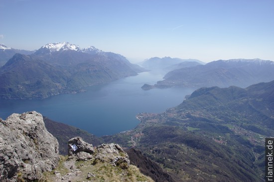
Lake Como has the shape of an upside-down Y on the map, with the branches of Como and of Lecco in the south meeting at the peninsula of Bellagio. It is up to 425 m deep (at Argegno in the branch of Como), making it the deepest lake in the Alps. The deepest point is thus more than 200 m below sea level. However, the aforementioned gorge was much deeper, it was only filled up to half with sediments. It was a V-valley with steep slopes on both sides, whose former valley floor at Argegno is about 700 m below today’s sea level.
For a river to incise such a deep valley, something extraordinary had to happen, of course. This was the so-called Messinian salinity crisis in the late Miocene. At that time, the strait between the Mediterranean and the Atlantic Ocean fell dry (it was not in the place of today’s Strait of Gibraltar) because the region there was uplifted. In the Mediterranean, however, evaporation was much higher than the amount of water supplied by rivers. The water level therefore continued to drop until eventually the entire sea basin dried up, leaving thick salt deposits in the deepest basins.
Before the Messinian salinity crisis, the Adda probably flowed into a sea bay near Como. As the sea level dropped, it began to cut deeper and deeper into the rock. In the foreland south of Como, this was the southern Alpine molasse, i.e. sandstones and conglomerates that had just been deposited at the fringes of the Alps and were easily eroded.
Obviously, the tectonics of the Southern Alps interfered with the formation of the gorge. The rocks of the Southern Alps, unlike the nappes of the Central and Northern Alps, were hardly involved in the displacements of the orogeny, but there was nevertheless a slight shift of small nappes in a southerly direction. Possibly this led to the fact that our river had to look for a new path and cut a second gorge, today’s branch of the lake of Lecco.
Eventually, the seawater from the Atlantic flowed back into the basin of the Mediterranean, and the salt layers have since been buried under younger marine sediments. Our gorge also filled up and formed an estuary that looked like a fjord. The Adda brought large amounts of material from its hinterland, which largely filled the former gorge.
During the ice ages, ice flowed down from the ice sheet of the Alps, through both branches of today’s lake and flowed out into the Po Valley at Como and at Lecco, where it spread in the form of Piedmont glaciers. In the area of the later lake, the glacier cleared out a small part of the young sediments and reshaped the sides. South of Como and Lecco, large terminal moraines accumulated. After the Ice Age, the lake remained, and the Adda has since flowed out of the lake at Lecco towards the Po. The other large lakes of the Southern Alps were naturally formed by the same processes.