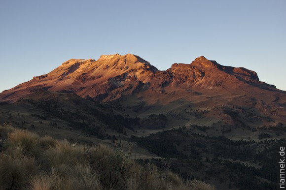
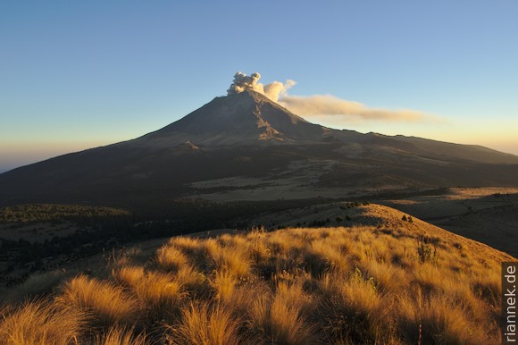
Unlike its famous (and somewhat higher) neighbour Popocatépetl, the volcano Iztaccíhuatl (5230 m) is not active (at least there was no eruption in the Holocene) and is not cone-shaped. It is a long ridge with a whole series of (more or less recognisable) craters. The name means “sleeping woman” with the two highest peaks representing the breasts and the various secondary peaks representing the head, belly and feet. She lies stretched out exactly in line with Popocatépetl. Since you are not allowed to get even close to her active brother, it is a popular destination, especially since you have very nice views of Popocatépetl. (See also The Formation of Mountains.)
Coming from Nevado de Toluca, I have to cross Mexico City, which takes so long that I am already afraid that everything is too late, too late to get a permit for the national park at the office in Amecameca (at the foot of the pass road), or because (according to the internet) the gravel road from the pass to the starting point La Joya might only be open during daylight. I wanted to bypass the town on a motorway, but was waved out at the first toll booth because it only works with a telepass. Then hours in congested streets, further slowed down by several accidents. Instead of going through the centre, I want to go south as quickly as possible and take smaller roads along the outskirts of the city. The former works halfway, but later roads are closed again and again, and I zigzag through poor neighbourhoods. In places the street is broken into slanted blocks, I also see many destroyed houses. Probably a result of the earthquake.
Anyway, I don’t get my permit at the bottom, but without any problems on the pass, the barrier is still open, and I rumble up to the La Joya car park, where I spend a short night in the rental car at an altitude of a little under 4000 m.
At 3am I start walking in the light of my headlamp. A short stretch flat to La Joya proper, then a sharp turn towards the right up a path. The path winds upwards around the rocks of a ridge. At the last saddle, I pass the bivouac hut (after 2h30, guidebooks say 3 to 5 h), then it goes up more steeply.
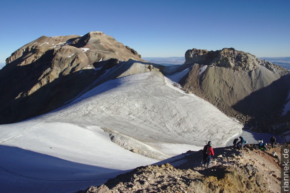
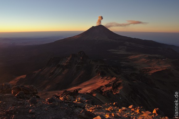
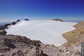
At dawn, Popocatépetl is clearly visible, greeting me with a small ash eruption. I take smaller and smaller steps, puffing, but the acclimatisation at Nevado de Toluca pays off, and soon I am standing on the first of the secondary summits at an altitude of over 5000 m (1 h 30 from the bivouac). Here the view is perhaps the best. But the main summit is still far away, more than 2 h, it goes from one secondary summit to the next (the “belly”). Eventually you have to cross a small glacier that fills a crater. It is largely flat, but you should have crampons for the first bit.
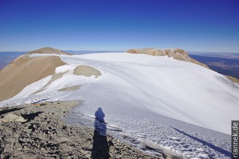
A curved ridge of colourfully altered rock follows, over which you finally reach the southern of the two main peaks. To reach the slightly higher northern ridge, you have to cross another glacier, this time completely flat.
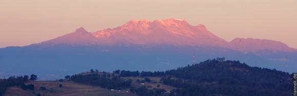
Downhill I am way faster, of course, and arrive at the car park in the afternoon, where I first order tacos at a snack bar…. And then I stay another night in the national park to take some photos of the two volcanoes, “Popo” and “Itzi”.
Links
- Iztaccíhuatl at Global Volcanism Program
- Popocatépetl at Global Volcanism Program
- Iztaccíhuatl at Summit Post (praktische Infos)
- Iztaccíhuatl at Peakbagger (GPS-Tracks)
Read on
The Formation of Mountains
From Cancun to Mexico City
Nevado de Toluca
Mexico City and around
Puebla and Cholula
El Chichón