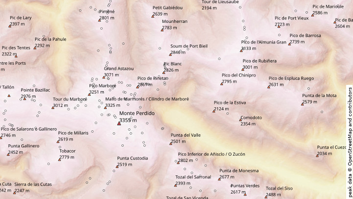
Did you ever try to draw outdoor topographic maps using OpenStreetMap data? You probably noticed that all peaks look the same on OpenStreetMap, both minor and major summits. On OpenStreetMap, it is nearly impossible to find the main summit of any mountain massif. My QGIS plugin nearest with greater value provides an easy way to classify peaks in order to style major and minor summits differently.
In my example, I first extracted all peaks (in OpenStreetMap data: tag “natural=peak”) into a separate layer. Now I used the plugin nearest with greater value with ele as “field to compare”. In symbology of the output layer, I used rule-based symbology:
"neargtdist">10000for dominant peaks (the next higher peak is >10 km away).("neargtdist" > 1000) AND ( "neargtdist" <=10000) AND ("name" IS NOT NULL)for major summits (the next higher summit is >1km away)ELSEfor minor summits (shown as black rings in the figure).
Note that I added "name" IS NOT NULL for the rule of major summits. The reason are some minor hills in wide valleys that were classified as major summits otherwise.