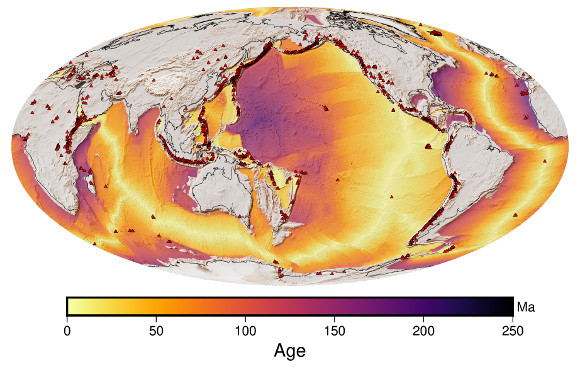
The study of the ocean floors provided decisive arguments that led to the theory of plate tectonics gaining acceptance in the 1960s. In fact, the drift of the continents and the emergence and closure of the oceans is obvious on maps that show the age of the oceanic crust. Through the processes of plate tectonics, oceanic crust is constantly recycled; it is newly formed at the mid-ocean ridges, and disappears again at the subduction zones (see also my book The Formation of Mountains). For this reason, the ocean floor is nowhere particularly old on the scale of Earth’s history.
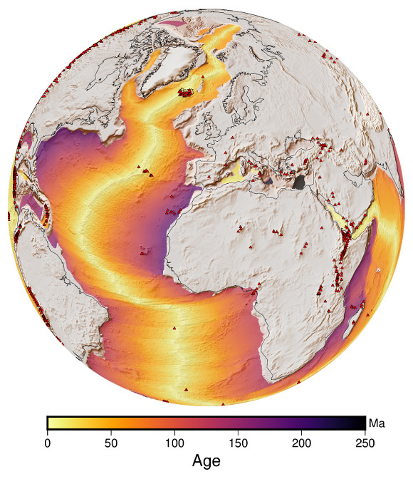
I show two maps that were plotted with PyGMT: The world map is in Mollweide projection, the colormap is “inferno”. The other map shows the Atlantic Ocean. It is particularly clear how this ocean is opening up like a pair of scissors, while Siberia and Alaska are still connected. This map is in orthographic projection.
Since I discovered PyGMT, this has been one of my favourite tools for plotting maps. You can download and plot not only the topography (DEM) but also the age of the oceanic lithosphere:
age = pygmt.datasets.load_earth_age(resolution="10m")
Using masks, I have combined this with the topography. The position of the volcanoes is from the Global Volcanism Program.