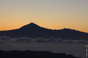
It was about time that I paid a visit to the Canary Islands. After all, Teide is the highest hotspot volcano after Hawaii’s and much quicker to reach… However, there are also a few important differences to Hawaii, for example, a stratovolcano like Teide is not exactly typical of a hotspot, nor are the large amounts of highly evolved magmas (cf. my book The Formation of Mountains). An important point is, of course, that the African plate moves very slowly, the hotspot does not move from the spot, so to speak.
But is it a hotspot or a mantle plume at all? There is a minority (?) of researchers who doubt this. For example, La Gomera, which lies “on top” of the hotspot (La Palma is the most active island), has not been active for a long time (Tertiary), while the islands of Lanzerote and Fuerteventura, which have already migrated somewhat, are active. Perhaps tensions in the lithosphere are responsible for melting (in a possibly metasomatically altered mantle)? The Canary Islands lie in the extension of the Atlas Mountains… This old and still propagated theory fits well into the current fashion to doubt the existence of mantle plumes altogether: are hotspots really hot and not rather wet? Are they really spots and not rather larger regions? And above all, are there really mantle plumes rising thin as a finger from the lower mantle? And so on. Plume or not, the continuation of the South Atlas shear zone (a strike-slip fault) into the Atlantic could control when and where (by slight extension) eruptions occur.
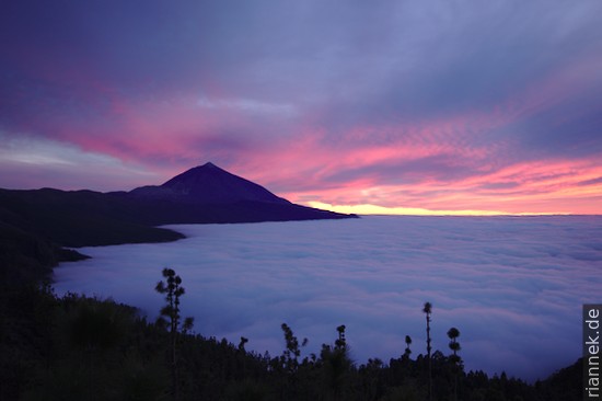
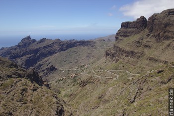
Anyway, on Tenerife, somewhat atypically for my usual travel style, I had a pre-booked hotel in the mountain village of Vilaflor and a rental car. I thoroughly enjoyed speeding from one vantage point to the next, trying to get the best possible lighting conditions for taking photographs.
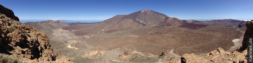
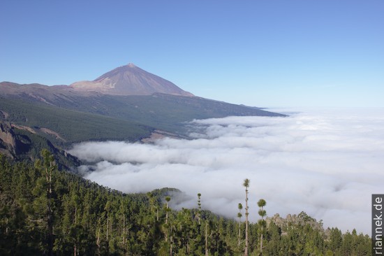
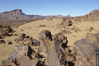
I spent most of my time in the beautiful Cañadas caldera, including a traverse of the Teide, which gets its own article. The origin of the Cañadas caldera is no less controversial, especially because the rim of the caldera is missing on the north side (where Teide, which was only formed afterwards, stands). Is it really one or more calderas (i.e. a collapse structure after the emptying of a large magma chamber) or the horseshoe-shaped rim of a scar caused by a landslide (flank collapse)?
Some time ago, most researchers assumed that it was two calderas separated by the Roques de Garcia, a remnant of the ancient Cañadas volcano. When the submarine fans of the landslide masses were found in the sea in the mid-1990s, the discussion seemed decided in favour of the other theory. According to this, the rim of the caldera was the upper end of the Icod valley formed by the landslide. Quite similar to the valleys of Orotava and Güímar, which had also been created earlier by landslides.
In the meantime, however, there is increasing evidence that it is a caldera after all, or rather probably three calderas that formed one after the other. No one doubts the Icod landslide, but it may have been smaller, with the final wall of the horseshoe buried under Teide. In addition, there were large eruptions before the landslide, each of which is sufficient for the formation of a caldera.
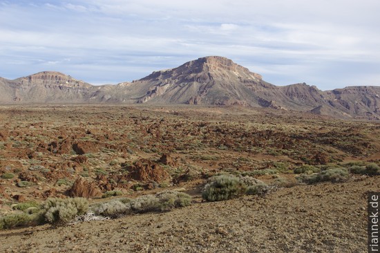
Obviously, the activity shifted further and further to the northeast: first the Ucanca caldera was formed (west of the Roques de Garcia), then the Guajara caldera (in the centre, east of the Roques de Garcia) and then the Diego Hernández caldera (the northeast of the Cañadas caldera). The volcanic rocks ejected during the associated eruptions largely build up the present-day rim of the Cañadas caldera (rocks from the original Cañadas volcano are only present in the lowermost part of the rock wall), while the collapse structures themselves are hidden beneath the younger lavas of Teide.
The Icod landslide probably occurred immediately after the last caldera formation. One speculation is that it was triggered by the tremors of the caldera formation, but perhaps it happened later and independently. According to another model (whose authors consider the caldera wall to be the scar of the landslide), the landslide triggered an eruption through the depressurisation of a magma chamber – which started the rapid growth of a new volcano, the Teide.
It is interesting that when (indirectly) dating the landslides, the dates correspond to times when the sea level was particularly low (ice ages…). So it is also conceivable that the lowering of the sea level caused the volcano to become unstable.
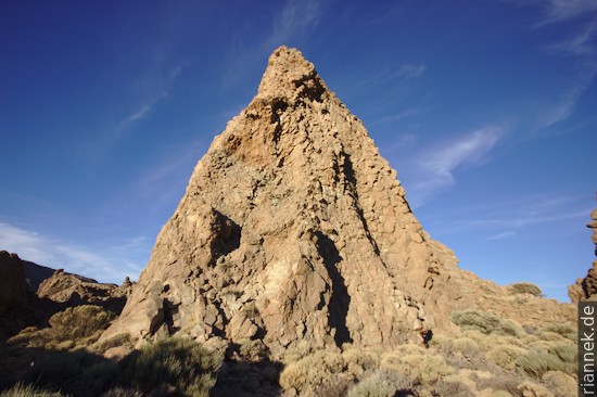
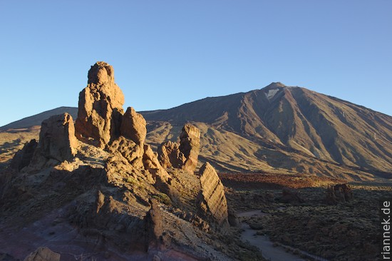
The best overview of the Cãnadas caldera is from Guajara, the highest point of the caldera rim. It can be climbed from the Roques de Garcia.
Only the lowest part of the Guajara (a few strangely shaped orange rocks) consists of units of the older Cañadas volcano (Las Cañadas Lower Group). It is overlain by the Ucanca Formation, the products of the eruptions that formed the Ucanca Caldera. The entire upper half of the mountain is the Guajara Formation, which is related to the formation of the Guajara Caldera directly below. Both formations consist of fall deposits and ignimbrites (deposits of pyroclastic flows), but these have largely been deposited so hot that they are welded into a solid rock that almost looks like a lava flow. A single lava flow (basalt) exists in the Ucanca Formation. Both formations are called the Upper Group of the Cañadas Volcano. The third and youngest formation of the Upper Group, Diego Hernández, can only be seen further east.
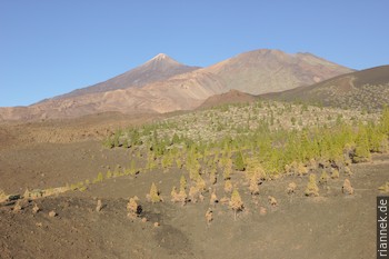
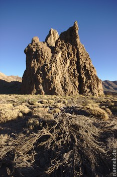
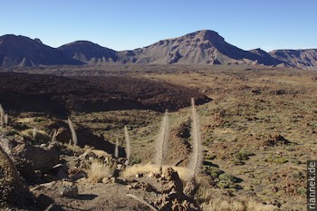
(…a cinder cone of the Santiago del Teide rift zone)
In historical times, eruptions took place not only on Teide itself, but often at “one-off volcanoes”, at cinder cones located on the extension of the Pico Viejo – Teide – Montaña Blanca line. These are the active rift zones where extension allows magma to rise. At the so-called Santiago del Teide rift in the northwest, countless cinder cones and lava flows can be seen, on which the yellowish-green pines are slowly gaining a foothold.
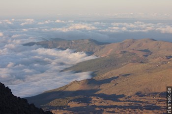
The rift zone in the northeast is the Cumbre Dorsal mountain ridge, which is worth visiting especially for the many viewpoints (e.g. Chimaque).
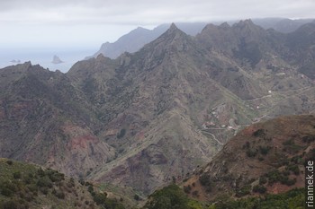
To make the geological history of the island complete, I also visit the Anaga Mountains on the north-eastern tip of the island and the Teno Mountains on the north-western tip. These are two heavily eroded shield volcanoes that once built up as independent islands as precursors to Tenerife (the third shield volcano, the southern tip of Tenerife, is largely covered by the younger units of the Cañadas volcano).
Shield volcanoes made of basalt are typical of a hotspot. Only later, when the Cañadas volcano built up between these shield volcanoes, did the three islands grow together into one. Now the composite volcanic edifice was also unusually thick, and at the same time the lower crust also thickened due to underplating. This crustal thickness may have led to magma generally “getting stuck” and evolving into highly evolved melts such as phonolites and rhyolites in a magma chamber before being extracted in an explosive eruption or quietly as an obsidian flow.
This also changed the shape of the landscape, the slopes became steeper, calderas were formed and so on. Away from the centre of the island, at the aforementioned rift zones, the crust is not quite as thick, so basalts are still erupting here.
Literature
- Boulesteix, Hildenrand, Gillot, Soler 2012. Eruptive response of oceanic islands to giant landslides: New insights from the geomorphologic evolution of the Teide–Pico Viejo volcanic complex (Tenerife, Canary). Geomorphology 138, 61-73.
- Gottsmann, Camacho, Martí, Wooller, Fernández, García, Rymer, 2008. Shallow structure beneath the Central Volcanic Complex of Tenerife from new gravity data: Implications for its evolution and recent reactivation. Physics of the Earth and Planetary Interiors 168, 212-230.
- Geyer, Martí, 2010. The distribution of basaltic volcanism on Tenerife, Canary Islands: Implications on the origin and dynamics of the rift systems. Tectonophysics 483, 310-326.
- Ablay, Marti, 2000. Stratigraphy, structure, and volcanic evolution of the Pico Teide-Pico Viejo formation, Tenerife, Canary Islands. Journal of Volcanology and Geothermal Research 103, 175-208.
- Martí, Gottsmann, 2005. Field Guide to the las Cañadas Caldera Volcanism. Workshop “Caldera Volcanism: Analysis, Modelling and Response”.
- Ablay, Hürlimann, 2000. Evolution of the north flank of Tenerife by recurrent giant landslides. Journal of Volcanology and Geothermal Research 103, 135-159.
- Viñuela, The Canary Islands Hot Spot. www.mantleplumes.org.
Read on
Traverse of Teide and Pico Viejo
La Palma: Hiking Ruta de los Volcanes and Ruta de la Cresteria (GR 131)
La Gomera
The Formation of Mountains