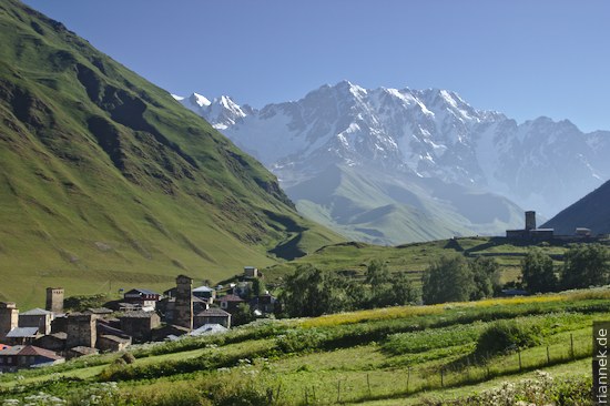
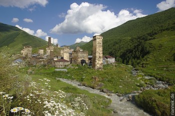
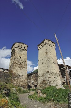
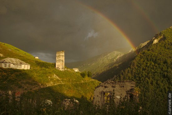
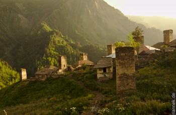
Svaneti is one of the most beautiful regions in the Caucasus (cf. The Formation of Mountains). Huge mountains of rock and ice, their high walls comparable to the Himalayas; and in the valleys picturesque villages teeming with medieval fortified towers. This is especially true of Ushguli, where a whimsical medieval skyline sits against a backdrop of Georgia’s highest mountain, Shkhara (5201 m).
Mestia, the main town in the region, can be reached by a good road, while places like Ushguli can only be reached on bumpy tracks. So it makes sense to walk at least part of the way, especially as you pass other villages and mountain faces worth seeing. This is one of the most popular trekking routes in the Caucasus, and rightly so. Maps were available free of charge at the tourist information office in Mestia, but the red line only roughly corresponds to the actual route.
It usually takes four days, though it really is better to walk from Mestia to Ushguli than the other way round. The reason is a huge river that has to be crossed without a bridge. Without a horse, this is dangerous in the early morning and completely impossible in the afternoon when the water level is higher. In Adishi, two hours away from the spot, you can stay overnight and organise horses, while on the other side there is nothing but a high pass. The return trip can easily be organised in Ushguli. To stay overnight, there are simple homestays in the villages.
Since we didn’t know about the river, we made the trek in the opposite direction. In Ushguli, we explored all four parts of the village extensively. Then we hiked for half a day down the unpaved road through a gorge to the next village, Kala. The route now follows the side valley to the right, respectively first up to a church and then into the valley to the village of Khalde. It is abandoned except for one guesthouse. Most people spend the night in Kala or at the church, but if you want a good view, you should prefer Khalde. From here you have a great view of the valley with the high wall of the 5000m peak Dzangitau. Here we also learned about the river and the guide of an oncoming group promised us to organise a horse by phone.
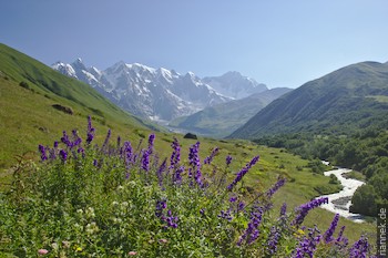
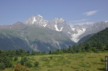
The next morning we hiked further up the valley towards the white mountain face. Near an abandoned alpine pasture we turned left, up the slope. At noon we reached the pass, with the most beautiful view of the hike. Directly in front of us the huge mountain wall that starts on the left with the pyramid of Tetnuldi and continues on the right with Dzangitau (unfortunately, the different maps cannot agree on the order of the secondary peaks like Shota Rustaveli) to Shkhara. Between the two, a large valley glacier flows downhill, responsible for the problematic river. At a greater distance, the double peak of Ushba can also be seen in the west.
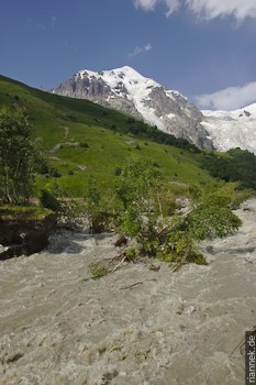
The path leads very steeply down to the river, where no horse was to be seen far and wide. In the wide rushing stream, fallen trees bobbed and the clacking of stones moving at the bottom could be heard constantly. After a few hours, we prepared to bivouac without a tent.
In the evening, a horseman who happened to be passing by suddenly stood next to us. He brought us and our luggage safely to the other side, the river being so deep that even the horse’s belly was under water. Two hours later we reached the pretty village of Adishi in the sunset atmosphere.
On the following stage, the map was the least correct, we stick to the red line and break through the undergrowth on overgrown paths, only to see a group on a wide path hours later. It’s only a gentle climb, mostly just above the tree line, until you reach a ridge that descends from Tetnuldi. The entire ridge has just been a construction site; a new ski area with freshly levelled slopes is being built here. Of course, this makes the hike less attractive. Deep down in the valley, you finally reach Zhabeshi.
The next stage first follows the wide valley down, in which there are some larger villages with many towers, although the mountain views are not so grandiose. The trail continues above the river and finally crosses the ridge that closes the valley downwards (except for a narrow gorge). Here you have a great view up the valley to Tetnuldi to the east. On the other side to the west you see across another valley towards the double peak of Ushba. It is not far down to Mestia.
Read on
Trekking in Tusheti
Kazbegi
Svaneti
The Formation of Mountains