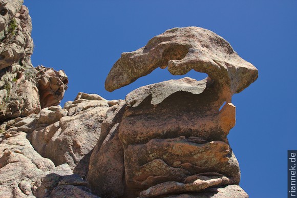
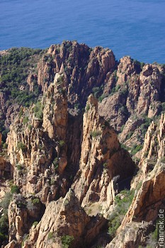
I consider the Gulf of Porto, lined by mountains, to be one of the most beautiful corners of Europe, even if Porto itself is relatively boring and very touristy. The Calanche di Piana, the rocky landscape on the road between Porto and Piana, are even a UNESCO World Heritage Site. The granite rocks have eroded into bizarre shapes, with so-called tafoni often visible alongside towers and embrasures. This is the name given to a special erosion form in which the inside of a granite block has weathered out, while the outside is partially left as a hard shell. (See also my book The Formation of Mountains.)
Hardly any tourists miss a walk from the Tete du Chien car park (with a tafoni in the shape of a dog’s head) to the Chateau Fort (1 h there and back). Even busier is 500 m further on, from the restaurant Les Roches Bleues, on a stretch of road about 1 km long; it is teeming with pedestrians, every parking bay occupied and cars stopping at every bend in the middle of the road so that a photo can be taken. Rightly so, but it is all the more surprising how little is happening on the mule track that runs a little higher up and has almost even more beautiful views of the rocks and the sea. It begins 300 m west of Les Roches Bleues next to a statue of the Madonna. After a short steep start, it continues relatively flat, then down to a football pitch, from which you come back to the road, which you follow to the right to the starting point (1:30 h round trip).
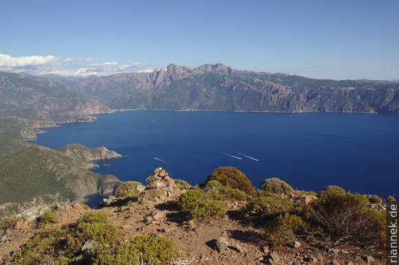
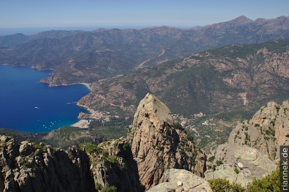
The car park at this football field is also the starting point for climbing Cabo d’Orto, the mountain that looks impregnable from Porto. We make a diversion via the Foce d’Orto saddle, from where a steep route marked with cairns leads steeply up through the rocky world and meets the normal route before the final ascent to the summit. At the top, we have a great panoramic view of the bays and the mountains of central Corsica.
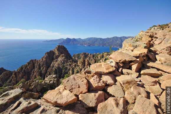
Incidentally, the granites at Porto are different from the “normal” calc-alkaline granites that build up large parts of the island. It is a ring complex formed by several magma pulses intruding rapidly one after the other at shallow depths. This happened anorogenically in the Permian, after the Variscan orogeny, during which most of the other granites on the island were formed. This ring complex consists of three concentrically arranged units. In the interior at Ota (a village up the valley from Porto) is a gabbro. It is surrounded by a light-coloured granite that contains other gabbro streaks. As this light-coloured granite weathers easily, this unit roughly corresponds to the course of the valley. The outer ring of reddish granite builds up the steep mountains on both sides of Porto, Cabo d’Orto and the Calanques are also part of it. It is conceivable that a caldera volcano was located above the ring complex at that time: Almost simultaneously, two calderas were formed nearby, Scandola (see below) and Monte Cinto.
The Genoese watchtower on Capu Rossu, at the southern end of the Gulf of Porto, is a popular short hike. Start from a car park on the small road that leads from Piana towards Plage d’Arone. The path descends a good distance and then climbs in a wide arc, but apart from the heat it is relatively easy (approx. 3 h there and back). The view down the high cliff is impressive. Capu Rossu is a small peralkaline granite that also intruded anorogenically.
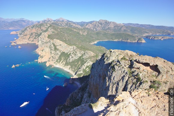
At the other side of the Gulf of Porto is the striking Monte Senino, surrounded by the sea on three sides, as the bay of Girolata adjoins behind it. This hike (approx. 4 h) is much trickier than the other routes, but the view of the sea and mountains is exceptionally beautiful. Start at the car park at the Bocca a Croce pass on the main road. Along the ridge you follow a dirt road to another pass and there branch off onto a path into the forest. The trail climbs steeply through a forest, with great views of the Gulf of Girolata every now and then. The path is not always clearly visible, but is well marked with cairns. The last bit to the summit of Punta Castellacciu is easy climbing. This was only the pre-peak, but most people seem to turn back here: The rest of the way is barely discernible as a path and several times it takes us a while to find the next cairn. The trail descends steeply into the saddle and mostly goes up and down on the southern side between rock towers and precipices. For a short stretch, the path leads through a narrow gully, from which you have to climb out a few metres at the top. Then follows the actual ascent to the summit, which is easier again.
On this hike you can see across the Gulf of Girolata to the Scandola nature reserve. Geologically, this is the remains of a volcano, also from the Permian: a caldera filled with ignimbrites, lavas, tuffs, lahars and dykes (basalt and rhyolite), although only a marginal part is preserved and we have to imagine most of the caldera in the sea. Monte Senino itself is a small volcano, probably related to this caldera.