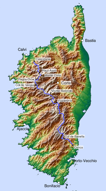
It is considered one of the most beautiful, wildest and toughest treks in Europe, if not the dream trek. The GR20 long-distance hiking trail (Sentier de Grande Randonnée 20) leads from Calenzana to Conca across the island, constantly up and down, a total of approx. 170 km and 12,000 metres in altitude (correspondingly more with detours to the peaks): for 15 or 16 days always following the red and white markings.
That it is the hardest trek in Europe is more of a myth (perhaps this was true when the huts were not yet staffed and you had to carry your food; my hardest trek is still a hike through Lapland). It is really beautiful from the first to the last stage and unusually varied. And unlike in the Alps, there are hardly any roads, hotel complexes, cable cars and ski slopes in the mountains of Corsica.
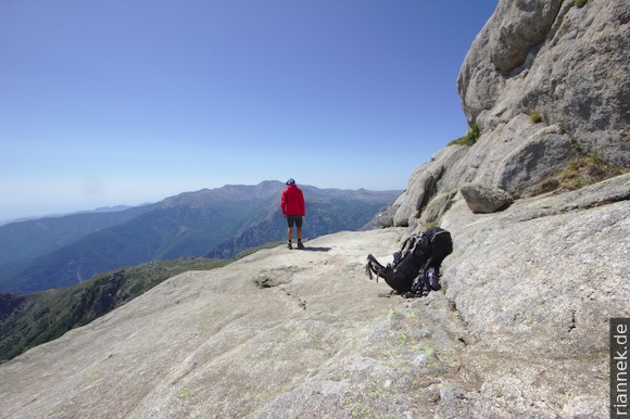
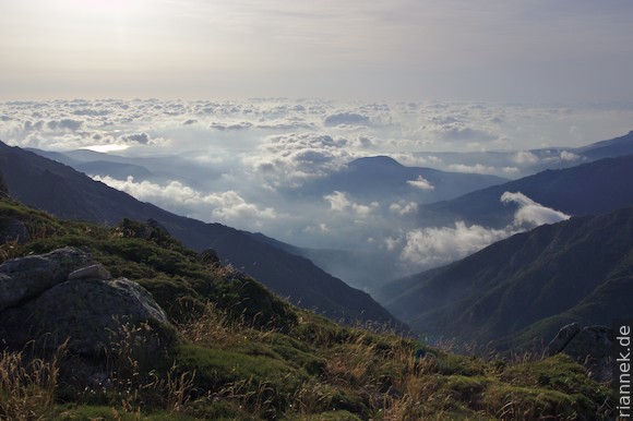
GR20, that is … Get up early, have breakfast with a headlamp and start walking at dusk so that you have completed the first ascent before it gets unbearably hot. Hiking over alpine paths or rocky slabs, magnificent views of granite rock towers and bastions and blue mountain lakes. Every now and then the sea can be seen in the background (or guessed at, often I can’t see a horizon line and the sky reaches a little too low to the curved coastline), sometimes even on both sides.
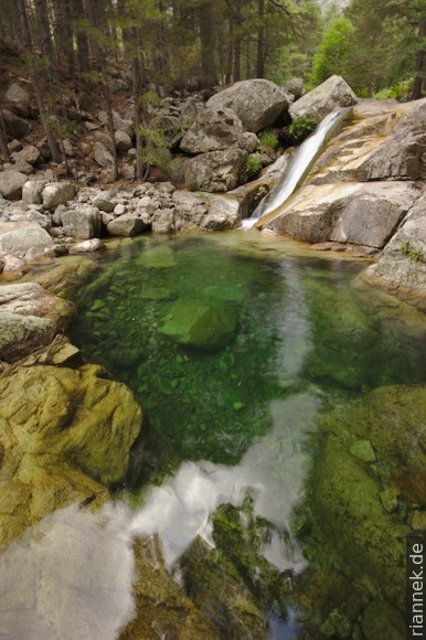
Short detours to the highest peaks, then jump into a pool under a small waterfall to cool down. Hardly feeling the pain in shoulders and calves. The scent of pines and macchia. Buying cheese at a bergerie and getting to know the variety of flavours over time – a welcome change from pasta from the backpack. Food can be bought every few days at certain huts.
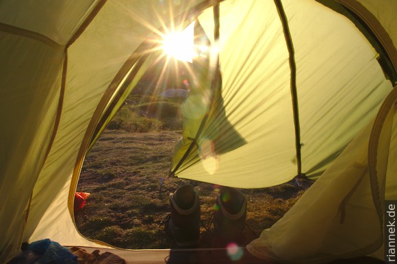
The village of Vizzavona at the pass of the Bastia – Ajaccio road divides the GR20 into a slightly longer northern half and a shorter southern half. There is even a train station here, handy for those who don’t want to walk the GR20 in one piece. Camping/bivouacking is only allowed next to the huts and at some Bergeries, partly because of the risk of forest fires, partly because it goes right through the Parc Naturel Régional de la Corse (the “regional national park”, so to speak). The huts are small and have a problem with bugs. They were often fully booked, but now the hut keepers are setting up a small tent city of identical tents as an extension, which stays up all season. The season is mid-June to mid-September, outside of which the huts are not staffed and you have to expect snow.
GR20 Northern part (Calenzana – Vizzavona)
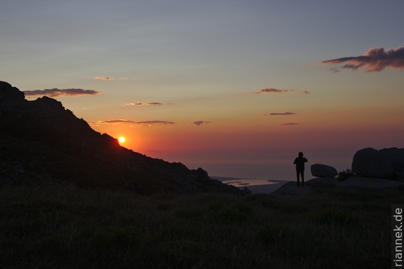
I reach Calenzana from Calvi airport in a short taxi ride. The mountains above the pretty village already look promising. I have dinner, do some shopping – and get up as early as possible the next morning. There is a very long climb ahead and it is already hot at sunrise. The backpack is heavy and still unfamiliar, but the beautiful views back to the sea and to Calvi motivate.
The first rocky ridge above Calenzana already shows that I will not only be walking over granite after all: it is a porphyry dyke, i.e. volcanic rock (see also my book The Formation of Mountains). It is more resistant to weathering than the granite surrounding it. I am approaching a caldera volcano here, the Monte Cinto caldera. The rocky peaks a little higher up, which I reach in the morning, are already part of the caldera; on the other rim are the mountains Monte Cinto and Paglia Orba. Of course, there is nothing of a crater-shaped cauldron to be seen, rather the high mountains consist of the former caldera filling (ignimbrites, surges, breccias), while the rim has been eroded away. The volcanic rocks are often altered and green or red (sometimes also green-red patterned), in the ignimbrites often beautiful fiamme can be seen (flattened pumice). The dyke in question is a ring dyke just outside the caldera.
Later, the traverse of a steep slope becomes quite strenuous, and tired, I reach the ruins of the Refuge d’Ortu di u Piobbu, which burnt down in spring.
The next morning I climb to Punta Pisciaghia, an impressive viewpoint. I look down into the cauldron-shaped valley of Bonifatu, with Monte Cinto and Paglia Orba towering in the background. Here you can see the whole caldera, so to speak. However, the northwestern part of the valley is made of granite, a small intrusion that has subsequently penetrated the volcanic rocks of the caldera filling (Bonifatu granite).
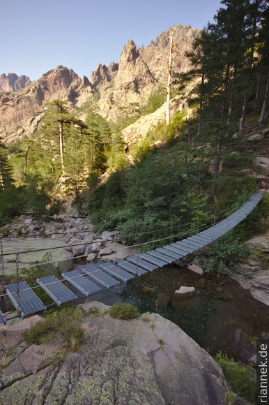
The path leads along the rim of the cauldron for a while, then I descend steeply into it to the Refuge de Carrozzu. Nearby, a very swaying suspension bridge swings over the stream (not entirely coincidentally, it reminds me of similar bridges in Nepal, it is a popular destination for day trippers), where I jump into the cold water for the first time.
The next stage leads over this bridge and then over rock slabs up the gorge to the small Lac de la Muvrella. After a break at a viewpoint above the lake, I continue to Bocca di Stagnu. In the valley below me is the small ski resort of Haut-Asco, with the massive chunk of Monte Cinto towering behind. Just a few years ago, the GR20 from Haut-Asco led up the valley to the right and then through the notorious Cirque de la Solitude. Today, it leads instead to a pre-summit of Monte Cinto, the Pointe des Eboulis, and from there to the next high valley.
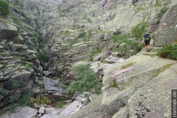
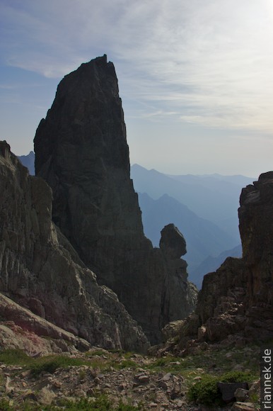
I want to take the old route here and omit the ski resort althogether: it’s not late, I’m in better shape than on the days before, the sky is cloudless blue – so I spontaneously take a variant that leads poorly marked over the ridge and past a rock castle in the direction of Cirque de la Solitude. After a long siesta in a shady corner, I reach the old GR20 and climb ever more steeply (a hut once stood here that burnt down a long time ago) to Bocca Tumasginesca (also called Col Perdu). Through the narrow saddle I look down into the steep rocky cauldron. Now I have to climb down 250 m in one line, only to climb up 300 m on the other side.
Here, 7 hikers were killed in a rock fall in 2015. The route was then closed, all chains and ladders removed and the markings painted over. However, I had read on the internet that it was open again for experienced alpinists. Now the cirque lives up to its name. As there are many small stones on the rock and it goes down in a line, I am glad that no one is climbing above me and that I do not have to take cover regularly.
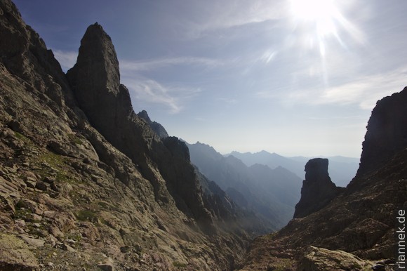
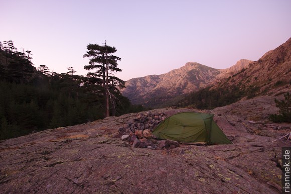
In a direct line I descend towards a prominent rock tower (staying on the solid rock as long as possible, not descending into the gully on the right), on the other side in the same direction a bit up again. As soon as I arrive next to the rock tower, I turn left and climb up to Bocca Minuta. Again and again I am happy to come across painted-over markings and the sawn-off hooks, so I can’t be wrong. From Bocca Minuta there is a long descent to Refuge Tighiettu, where I am taken aback by a sign that the route through Cirque de la Solitude is closed. I set up my tent just before nightfall. The rather uncomfortable bivouac sites here are Euro pallets carpentered against the slope.
Since I saved one day, I might as well spend it again and of course I want to climb Corsica’s highest peak, Monte Cinto. So I follow the new GR20 upwards with light luggage (a rest day for the shoulders at least). Behind me, the morning light colours the north face of the Paglia Orba orange. I reach the first bocca (pass), below me the Lac du Cinto, a little later I stand on the Pointe des Eboulis with a magnificent view.
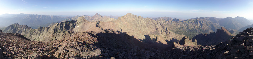
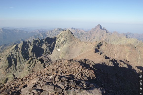
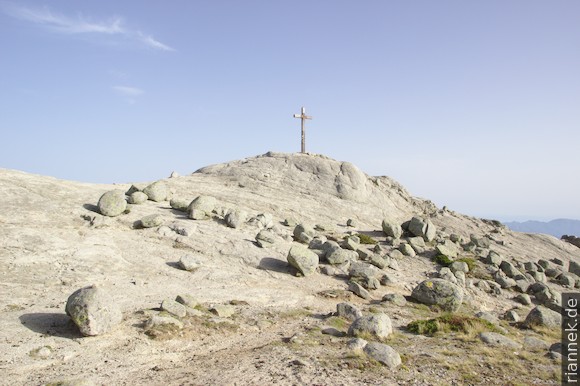
While the GR20 leads from here into the valley to Haut-Asco, I follow the ridge for an hour from pre-peak to pre-peak to Monte Cinto. Probably no one climbs it for the view (which is great, but not necessarily better than from the Pointe des Eboulis) or because the mountain has a particularly beautiful shape (more like a bulky block) or because the path is so beautiful (some call it a slog), but it is the highest mountain in Corsica and you can see far, a good part of the GR20 is visible.
At noon I take down my tent at the Refuge and put it up again a little lower at the Bergerie de Ballone, at a particularly nice bivouac site with a view and a few nice pools for swimming. Meanwhile, up above it rains, the Cirque de la Solitude would not have been possible today …
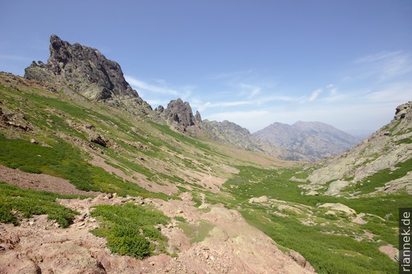
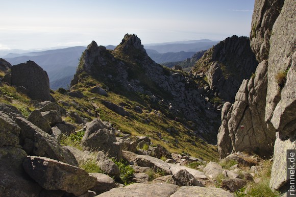
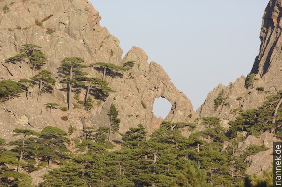
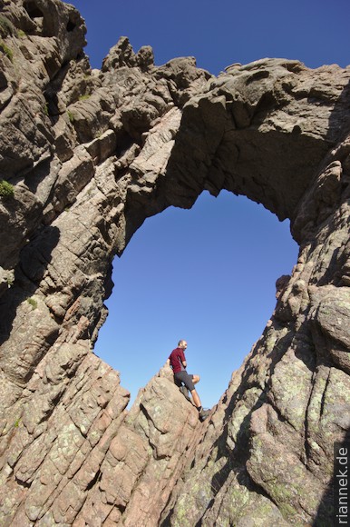
The next stage is a wide arc around the Paglia Orba – probably the most prominent mountain in Corsica – to the Refuge Ciuttulu di i Mori. There is a hole in the small neighbouring peak Capu Tafunatu and this is my destination for the afternoon. From the Col des Maures, follow the cairns to a rocky ledge. At its highest point (with green rock), do not follow the cairns straight down, but follow other cairns to the right, up a little, right again, 2 m down to another cairn.
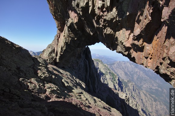
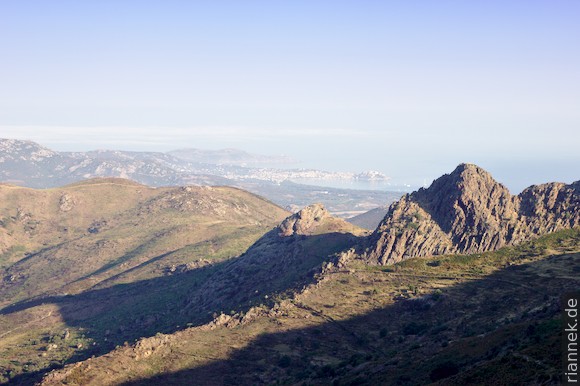
The rock gate is impressively large; when you stand inside it, it looks more like a narrow bridge, it is hard to believe how much rock is still above it. Through the gate you can see the coast with the Gulf of Porto.
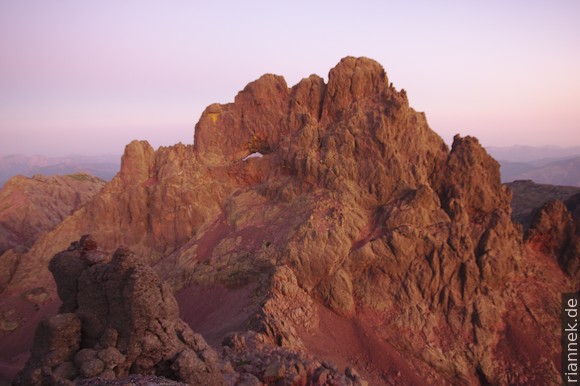
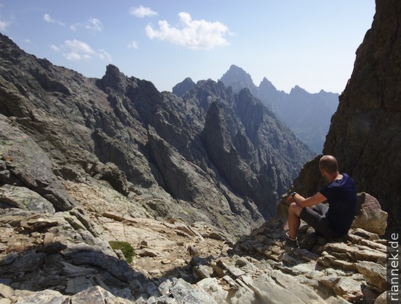
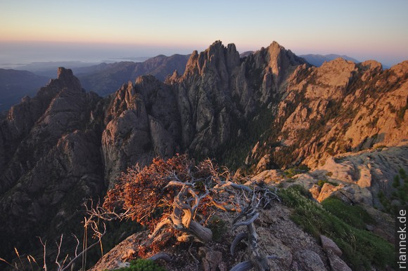
In the light of the headlamp I climb early in the morning towards Paglia Orba; I want to be as high up as possible at sunrise. It is not easy to find the cairns and the right gullies in the dark. The beautiful red volcanic breccia is grippy and climbing is easy. With many photo stops, I climb to the summit, with a view of half of Corsica. Particularly beautiful to see are the sinister Cirque de la Solitude, Monte Cinto and, in the other direction, the coast with the Gulf of Porto. If you only want to climb one mountain from the GR20, you should choose this one. And because it was so beautiful, I climb a second time to the rock gate.
In the late morning I take down my tent, rather late for the fact that I have a stage of 8 hours ahead of me. After all the highlights of the last few days, I ask myself what is still to come and this stage gives me the answer: a bit of variety after all the rugged rocks. I descend a high valley with beautiful pools (I only allow myself a short bath), then through forest, where I cross a road for the first time a little below the Col de Vergio pass (and buy fresh bread and other food at the campsite).
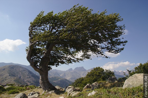
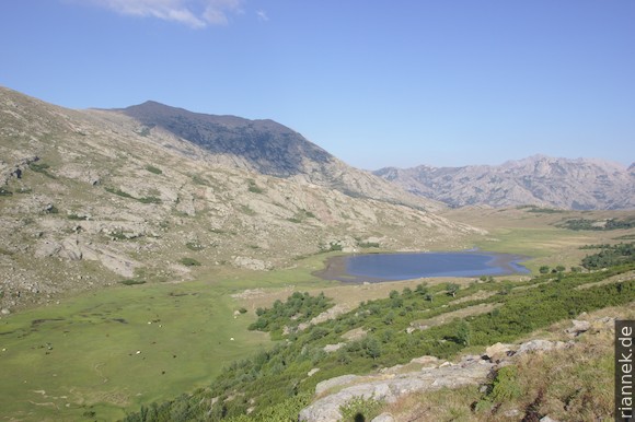
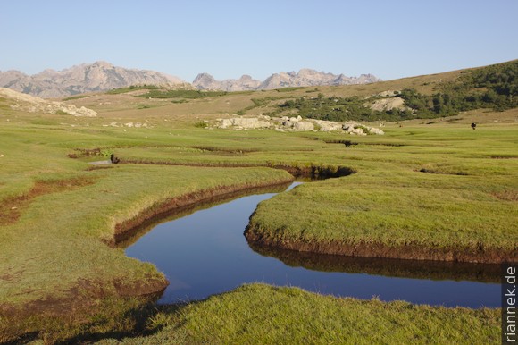
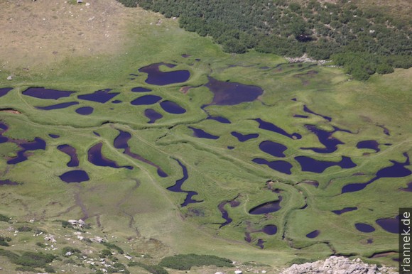
Over a ridge with wind-blown trees, the trail climbs again to a green plateau where Lac de Nino lies surrounded by marshy meadows. Cows and horses graze here, with the Monte Rotondo massif in the background, over which the following stage leads. With heavy legs, I carry my backpack on and reach the Bergerie de Vaccaghia at sunset. Here the cheese is particularly tasty and late in the evening the innkeeper sings Corsican songs with a few friends.
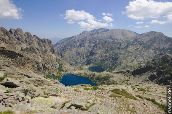
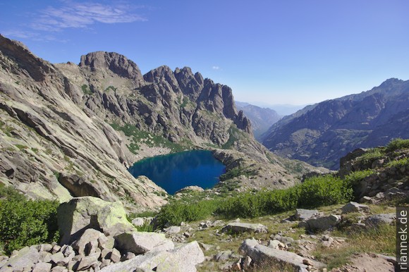
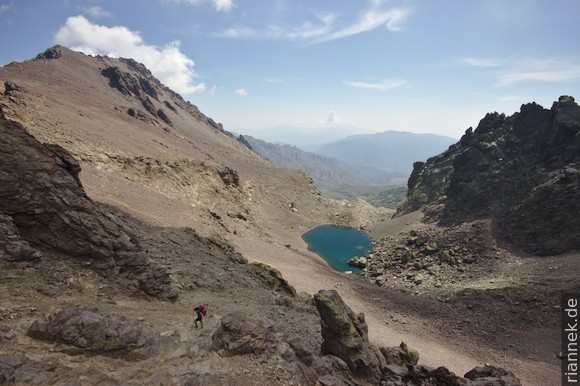
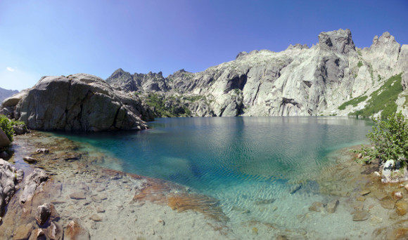
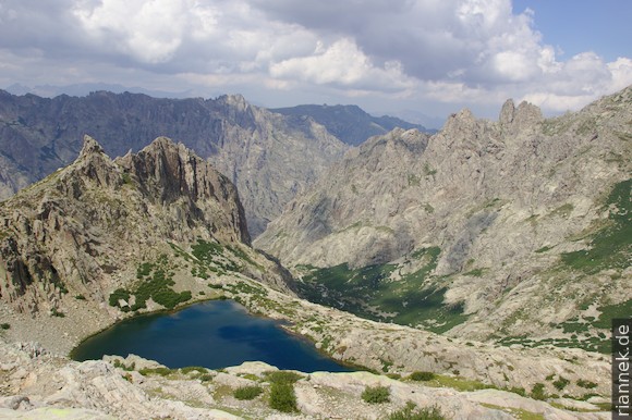
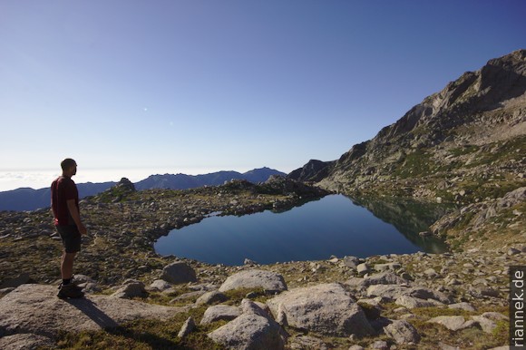
And again I hike up into the rocky world, to Bocca alle Porta, which is almost as high as the neighbouring peaks. Deep below me, two particularly beautiful mountain lakes, Lac de Capitello and one step lower Lac de Melo. I descend to the upper lake to swim a few lengths. From here, it’s hard to believe that the GR20 goes over the rocks up there.
The many day trippers drive me back up into the heights. I follow the ridge that curves around the end of the valley. Shortly after the next bocca, the next beautiful mountain lake lies below me, Lac de Rinoso. On the way down to the Refuge de Petra Piana, the next mountain comes into focus, the rock pyramid of Monte d’Oro.
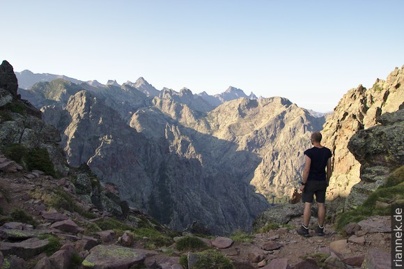
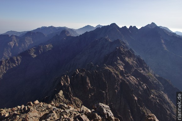
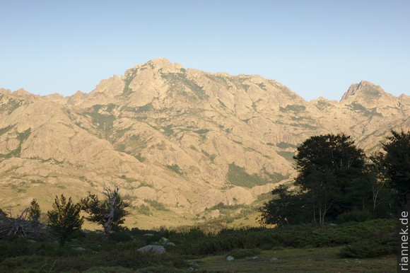
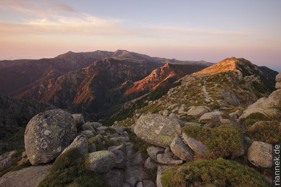
But first I want to climb Monte Rotondo, the second highest peak in Corsica. Again early in the morning I climb up, past the cirque lake Lavu Bellebone (which reminds me very much of the trek on Kaçkar Dagi), on to the crest and with a little scrambling to the summit. Again a great view in all directions, it is clearly to see where I come from and where I want to go. From here on, towards the south, each peak becomes successively smaller. There are unusually many clouds in the sky for the early morning …
From the hut, I am spoilt for choice: either the variant over the mountain ridge with beautiful views or the actual GR20 down the valley, past beautiful pools, and up the next valley again. I didn’t think I’d go for the valley, but the views are done away with as the clouds roll in, and besides, I fancy a bit of a change. The pools are really great, with small waterfalls. I stop several times to put on my swimming trunks again, while it is already raining in the mountains. Shortly before I reach the Bergerie de l’Onda, I get caught in a thunderstorm and pitch the tent in the rain.
There is lightning, thunder and rain all night. In the morning the lightning stops, but the tent ducks under gusts of wind and the heavy rain continues to beat down on the tent. The bivouac site empties, some take refuge in the hut, others give up and descend into the valley. Not a nice idea to descend in the lashing rain with the feeling of failure (on the path I came up yesterday). I prefer to stay in the halfway dry tent and take an involuntary rest day. My neighbour’s poles break and pierce the tent canvas like lances, a couple of rented tents roll across the bivouac site, one hangs from a string on the fence and bounces back and forth like a pendulum. In the evening the rain stops and the meadow fills up with tents again – a good sign.
When the alarm clock rings: Clear starry sky and on the horizon a red stripe announces the sun. I walk up to the ridge, where I leave my backpack and continue up to the summit of Monte d’Oro. From the top, the sea is clearly visible on both sides, but I notice that the mountains are somehow not turning their most beautiful side towards me. It is already noticeable from here how the character of the southern part of the GR20 is changing: less high, less steep and greener. I return to my backpack and descend towards Vizzavona. At a waterfall surrounded by tourists, I turn onto the variant over the Col de Vizzavona, thus saving myself the village and a few metres in altitude (there are also accommodations, restaurants and a small shop at the pass).
GR20 southern part (Vizzavona – Conca)
Immediately after lunch I continue, after all I have lost a day due to the rain: from the pass up through the forest until I meet the GR20 at the forest limit, coming straight up from the village. From the next shoulder I have another great view back, especially of Monte d’Oro. Then I walk almost parallel to the contour line through sparse forest, now and then with views, past two Bergeries to the Refuge de Capanelle (more precisely Gîte U Fugone, the actual Refuge Capanelle is about 100 m higher, different from what is marked in my hiking guide). The arrival is a shock, terrible how the small ski area has been dug into the slopes here, nothing grows on the tracks anymore.
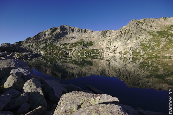
The Rother hiking guide doesn’t exactly praise the next stage: “Race track to the south”. Fortunately, there is a very beautiful alternative, namely over Monte Renoso. When I stand at the mirror-calm Lac de Bastiani in the morning, I am reconciled with Corsica again. I continue in a curve to the summit and then follow the ridge southwards, descend to a Bergerie and meet the GR20 again in the forest.
It leads me to a pass, the Col de Verde. After a sweaty climb (during which the view back reminds me again and again of Armenia and Nagorno Karabakh), I reach a green plateau with a view of the east coast with its lagoons. At the edge of the plateau, I pitch my tent at the Refuge de Prati.
The next day I hike up and down a long ridge. Lots of green, but also bulbous, columnar, humpbacked rocks. Right at the beginning, in the middle of the narrow path, there is a beastly smelling carcass of a mouflon. Today an icy wind is blowing, at least on one side of the ridge. When I walk on the other side, the sweat runs in streams; as soon as I cross again, I feel as if I’ve been thrown into an icebox with my dripping wet shirt. Monte Incudine comes into view, with the Bavella to the left – and thus the destination, so to speak. I reach the Refuge d’Usciolu at noon and spend a relaxing afternoon there.
The continuation of the ridge from the day before is called Arrête des Statues, and here the rock formations are a little smaller and they remind of statues. Via this ridge I reach a forest at the edge of a plateau below Monte Incudine. In a clearing I have a choice: either take the old route of GR20 directly to Monte Incudine (the hut on this route burnt down about 10 years ago) or take the new route in a wide arc past three Bergeries to Monte Incudine.
I take the old route. First it’s more over clearings than through forest, then the path leads through a strange hilly landscape overgrown with low scrub, ferns and wolfsbane. Tiny streams with English lawns at their edges meander through. Finally, I start to climb again, to the summit of Monte Incudine. Once again, a beautiful view: To the left and right the coast, below me the towers of the Bavella; in the background Sardinia can be glimpsed. Another steep descent and I reach the freshly rebuilt Refuge d’Asinau (in Corsica, mountain huts seem to burn down regularly …).
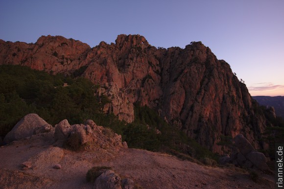
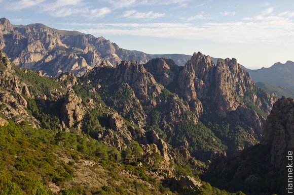
The Bavella consists of two crescents of rock towers, with the pass in between, a wooded hilly landscape. Geologically, it is an anorogenic granite complex with a coarse-grained granite in the centre surrounded by a fine-grained microgranite. A wide fault zone runs across it, hence the pass. Instead of walking in an arc around the rock towers to the Col de Bavella, I choose the alpine variant crossing the rock towers.
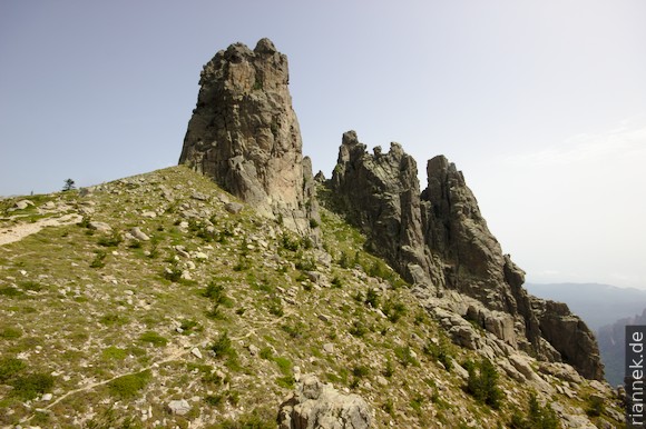
The way up is easy, in serpentines, towards a steep meadow between the towers. The landscape is indeed reminiscent of the Dolomites. Without luggage, I climb Tower III in a short, easy scramble. From here to the pass, it’s up and down with fantastic views and some easy climbs now and then.
After lunch at the Col de Bavella, I could easily walk to the Refuge de Paliri, but I have one day left and check into a gîte with half board (camping is strictly forbidden in the Bavella). I explore the area, especially at Trou de la Bombe, a hole in the rock popular with day trippers. Directly behind it, I climb the peaks Promotoire and Punta Velaco on unmarked paths, from where I have a tremendous view of the rock towers – so beautiful that I climb the Promotoire again at sunrise. Once a mouflon appears on a rock above me, looks at me curiously for a few seconds and disappears again.
After breakfast, I make the short walk over the Foce Finosa to the Refuge de Paliri. The path on the south side of the mountains is particularly beautiful and the Refuge de Paliri is the most beautifully situated hut of the whole trek. To celebrate the last evening, I eat the menu on the terrace and drink red wine, the good-humoured host unpacks the guitar and sings Corsican songs.
On the last stage, the GR20 really turns up the heat. In the upper section via Bocca di Monte Bracciutu and Bocca di u Sordu, the route passes through a fascinating landscape with rock towers rising above the pines. I am reminded of Kung Fu movies and would not be surprised to come across a Chinese monastery with Shaolin monks. Then the sea comes into focus, which is not far away. The path now descends, the maquis becomes denser, the rocks become smaller, the heat increases and the sea gets closer and closer. A last swim in a pool, then the final spurt to Conca.
I hitchhike to the nearby Fautea campsite, right by the sea next to two beaches – and twice a day the bus to Bastia passes by and stops on request.
It really was trop cool. In conclusion, I wonder if the GR20 makes it into my top 3 most beautiful treks. The competition is fierce and there is only one compromise: 1st place remains the Everest Three Passes Trek, 2nd the Cordillera Huayhuash in Peru and 3rd place is shared by Torres del Paine und GR20.