The valley Quebrada de Humahuaca leads north from the city of Jujuy to the border with Bolivia. In colonial times, this was the important link between Potosi — the mining town with its silver mines was about the size of London at the time and the economic centre of gravity of the Spanish colonies — and Salta and Tucuman, which existed mainly to supply Potosi. But the valley was already settled before the arrival of the Spaniards, as impressive ruins prove. In addition, there are the extraordinarily colourful rock formations (cf. my book The Formation of Mountains on the geology of the region). No wonder that the valley has been designated a UNESCO World Heritage Site.
It can be reached quite quickly from Salta on the motorway via General Güemes and Jujuy. The direct road from Salta to Jujuy, on the other hand, is not recommended; the narrow little road winds in endless tight curves along a forested mountain ridge.
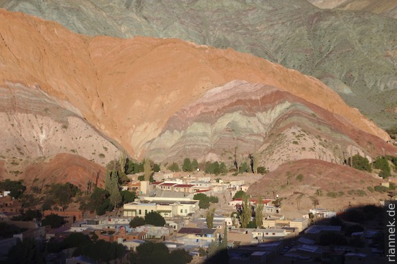
The most interesting part of the valley is between Purmamarca and Humahuaca. Purmamarca is a somewhat touristy colonial town 3 km up a side valley at the foot of a particularly colourful hill, the Cerro de los Siete Colores (Mountain of the Seven Colours). It is definitely worthwhile to walk around it (on a dusty little road, “Paseo de los Colorados”, 3 km, approx. 1 h) and also to climb the smaller hill next to the village, which serves as a lookout point. The best view, however, is to cross the riverbed at the entrance to the village and follow a steep path up the mountainside on the opposite side (preferably in the morning light).
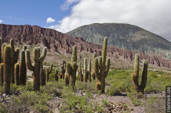
Further up the Quebrada de Humahuaca proper is Hornillos. This picturesque reconstructed colonial-era post station has pretty courtyards. The next town is Maimara, where the eastern flank of the mountain is also particularly colourful and is called “Paleta del Pintor”. The best view is from the large roundabout directly on the main road, across the cemetery.
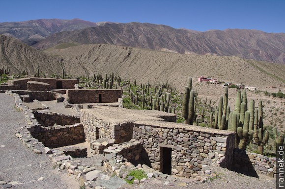
Next is Tilcara, where the (partly reconstructed) ruins of the pre-Columbian settlement El Pucará are definitely worth a visit. The small houses with their narrow entrance gates are located on the back of a hill, surrounded by cacti and a beautiful landscape. But the town itself with its colonial houses and museums is also interesting.
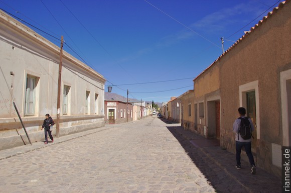
Further up in Uquia we are lucky, the small church is open for once, and we can look at the paintings showing the archangels in Spanish armour and with Spanish weapons — an impressive example of colonial propaganda. Finally, we arrive in Humahuaca, a pleasantly untouristy colonial and mining town.
On another day, we follow the road from Purmamarca in the side valley towards Chile, with impressive scenery. At first, quaternary gravel terraces and cacti catch the eye, before we dive into the fog at the pass.
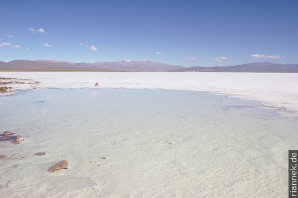
On the other side, we reach the Puna plateau under a blue sky, with a Salar shining bright white in the distance. We drive to the Salinas Grandes del Noroeste. This salar reminds me of the Salar de Uyuni in Bolivia, but it is much smaller and there are ditches for salt extraction. Nevertheless, the completely flat white surface is impressive (cf. Floating salt crystals).
The road continues across the Puna Plateau to San Pedro de Atacama (Chile), but we turn back.
Read on
Valles Calchaquíes (with Quebrada de Cafayate, Cachi and Los Cardones)
Talampaya and Ischigualasto (Valle de la Luna)
At the toe of Aconcagua
Iguazú Falls
Patagonia