There are many routes up Triglav, Slovenia’s highest mountain, and since all of them are scenic, I had a hard time choosing: from the north from the Vrata Valley via the via ferratas along the high and steep north face? Or rather the long, multi-day route from the south, from lake to lake and hut to hut through the “Valley of the Triglav Lakes” (also: “Valley of the Seven Lakes” or “Valley of the Five Lakes”)? The combination was too impractical for me, as I would then have to return to the car somehow.
Triglav
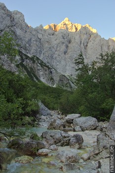
I decided to climb from the north — and to do a trek through the valley of the Triglav lakes afterwards. It was the first day with good weather after heavy thunderstorms, at sunrise I hiked up the Vrata valley from the car park of the Aljažev Dom hut towards the north face of Triglav.
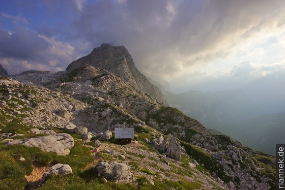
Three via ferrata routes lead up from here to the shoulders below the summit rock: the Bamberg route (Plemenice) to the right of the north face, the (easy) Prag route to the left of the north face and the Tominšek route a little further to the left. I took the Bamberg route on the way up, which is a little harder and less crowded and offers beautiful views of the north face. First, a path leads to the pass northwest of Triglav, where I put on the climbing harness.
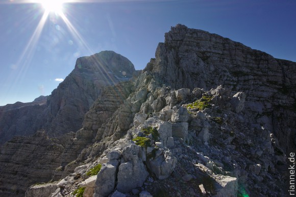
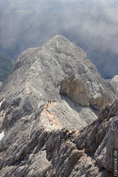
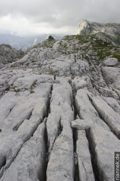
With beautiful views, the route goes up the steep ridge to a hilly karst plateau overlooked by the summit rock of Triglav. A second, easier via ferrata follows to the summit, which was already teeming with climbers who had climbed up from the other side. I had arrived just in time to enjoy the view, a little later the clouds billowed upwards and there was not much left to see.
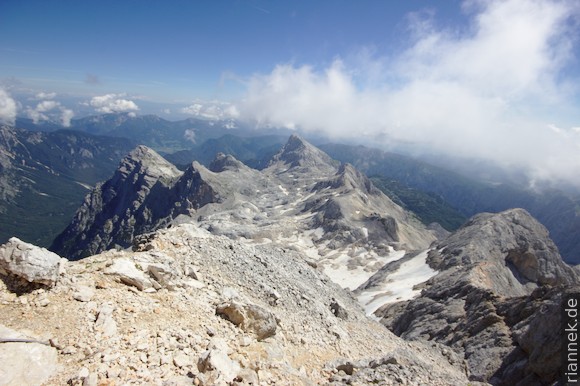
On the opposite (eastern) side, I followed the normal route over the ridge shrouded in clouds down to the Triglav hut. The crowds were too big for me to linger (it was lunchtime). Later I accidentally descended via the Prag trail (I had planned the more beautiful Tominšek trail, but had the tour description wrong in my head and only looked at the map, not at the notes). In the late afternoon I was already back down at the Aljažev hut.
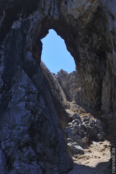
Prisojnik rock window
The next day I drove to the Vršič Pass, where there is an interesting via ferrata: The Prisojnik window route leads through a rock window about 50 m high. At the top, of course, I climbed to the top of Prisojnik, with a great view over the Julian Alps, before descending back to the pass via an easy trail.
On the way to Trenta, I stopped at the source of the Soča: the mountain river flows out of a small cave opening in the form of a siphon.
Triglav Lakes and Krn
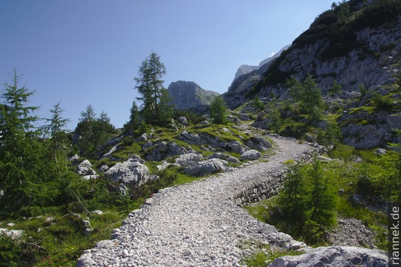
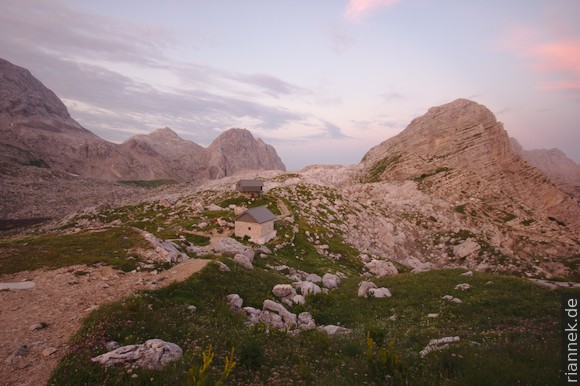
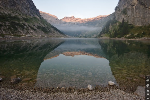
From Trenta I started a multi-day hike to the Triglav Lakes and the Krn (more or less like this route). A little way up the Zadnjica valley, then to the right to a saddle and finally on a well-built military path from World War 1 to the small hut Zasavska koča, beautifully situated on the top of Prehodavci. I used the afternoon to explore the surroundings, with small lakes, karren and beautiful views. I also climbed up to the saddle towards Triglav, but it was hidden in clouds.
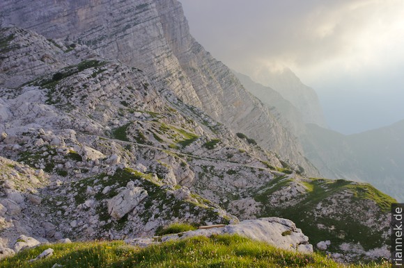
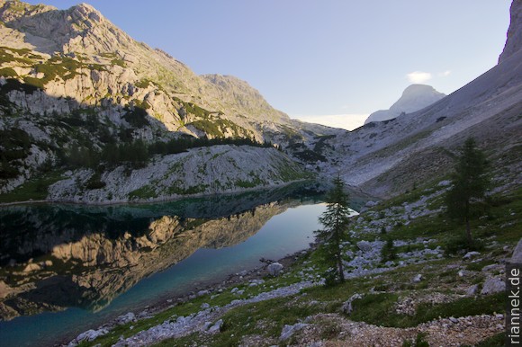
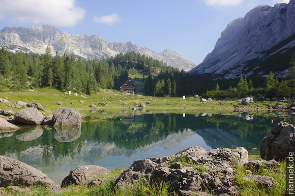
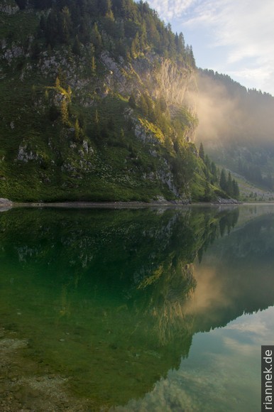
The next morning I hiked down the valley of the Triglav Lakes to the Triglav Lakes Hut. Really beautiful was the largest lake, Jezero v Ledvicah, halfway down. The small lakes near the hut, on the other hand, were full of algae and there was technical equipment like nets and pumps standing around to resque them. One was cordoned off with flutter tape….
In constant ups and downs, I now hiked mostly through sparse mountain forest (and past many bowl-shaped sinkholes) to the Bogatin Hut. After lunch I climbed up to a small pass and hiked down to the Krn hut. Of course I made a short detour to the very pretty Krn Lake, but also to Dupelsjko Jezero, hidden behind the trees right next to the hut.
I set off for Krn early in the morning (I had observed that this mountain was always one of the first to disappear into clouds at midday), and for breakfast I sat by Krn Lake at sunrise. The north side of the mountain is a steep rock face, but once you reach the saddle to the left, you realise that the other side is a steeply sloping meadow. The mountain was heavily fought over during World War 1 and remains of barbed wire can still be seen. From the summit I descended southwards over the meadows and turned off towards the village of Drežnica. After a second lunch in the only restaurant, I called a taxi and had it drive me to Bovec.
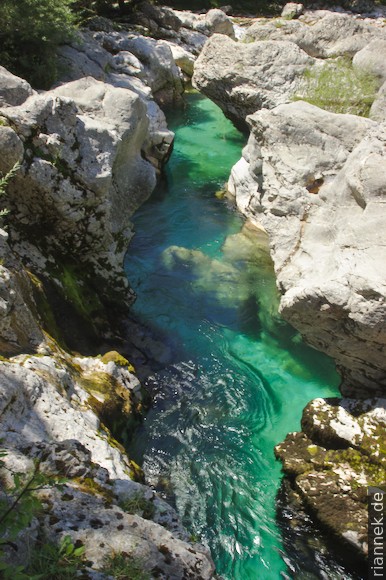
Soča
The Soča is a beautiful alpine river with turquoise to aquamarine green water. It is famous for kayaking and rafting tours, but the hiking trail from the source near Trenta to Bovec, the Soča Trail or Soška Pot, a stage of the Alpe-Adria Trail, is also popular. I take this trail to get back to the car from Bovec.
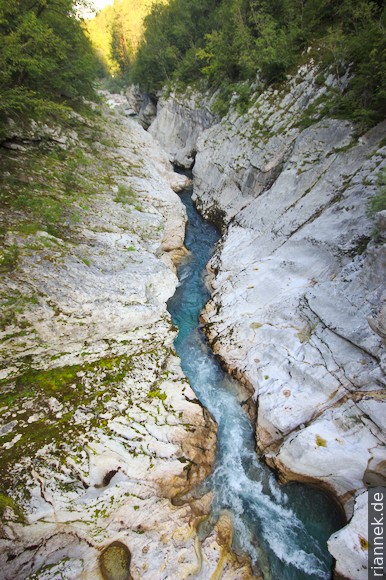
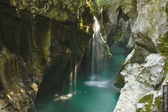
Most of the time, the Soča has a wide bed, with gravel and pebble beaches, large boulders, rapids and pools. Three times it squeezes through very narrow gorges a few metres deep. The water swirls down there in tight curves from one scour to the next. The most beautiful is the particularly deep Velika Korita, where a few small waterfalls also tumble down the side wall. At Zmuklica, the lowest gorge, I was quite early in the morning and therefore almost alone, which was very nice. Meanwhile, at Mala Korita, further upstream, there was already a crowd.
Wasserfälle und Schluchten
Mir blieben noch zwei Tage mit viel Regen. Ich ließ mich auf einem Campingplatz bei Bovec nieder, machte eine Raftingtour und ein paar Ausflüge…
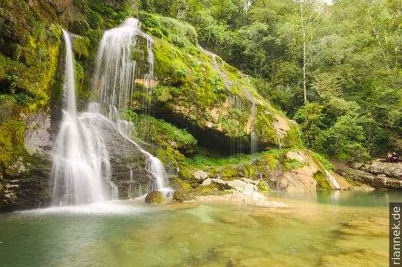
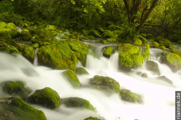
Near Bovec I visit the small but very pretty waterfall Slap Virje, the water trickling in curtains over calcarous tufa. Unfortunately, most of the water is diverted to a hydroelectric power station directly above, otherwise the waterfall would be even more impressive! The stream rises only about 300 m away in a karst spring called Izvir Glijuna: the water flows out of between moss-covered limestone boulders.
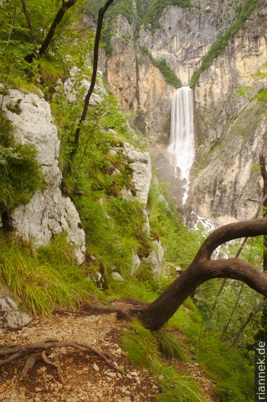
A few kilometres away is the most powerful waterfall in the country, Slap Boka (whose water, by the way, comes from a karst spring directly above the waterfall). I hiked upwards to the left (seen from below) of the waterfall, from one vantage point to the next until I stood higher than the top of the waterfall and could look down on it.
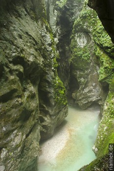
I visited the Tolmin gorges in such heavy rain that I could hardly take any photos, everything was immediately dripping wet. The gorge is pretty with some really nice spots, but the whole thing is very small and after half an hour I was back at the car.
Read on
The Formation of Mountains
Slovenian Karst
Istria
Rainy summer in the Eastern Alps