From Lescun, the Pyrenean Haute Route (Haute randonnée pyrénéenne, HPR) winds through the French Pyrénées National Park for more than a week. I pass by some highlights, including Vignemale, the rocky basin of Gavarnie and the iconic Pic du Midi d’Osseau.
From Lescun, I climb eastwards in the increasing heat, into the national park. I cross a pass over which many Jews fled to Spain (and mostly on to America) during World War 2. In the evening I reach Refuge d’Arlet (currently a construction site). Nearby, at my first (but not most beautiful) lake, I pitch my tent.
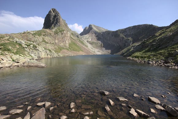
At sunrise I am already on the next hill, with a view of one of the most beautiful mountains of the Pyrenees, the Pic du Midi d’Osseau. But first I head south to the next ridge. In Spain, just over the border, I reach the beautiful lake Ibon de Astanés.
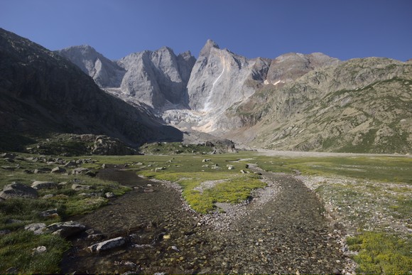
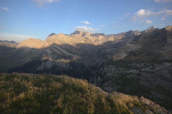
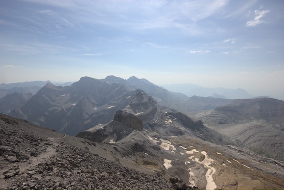
At noon I arrive in the ski resort of Candanchu. The little shop is even open, so I can load more food into my backpack. After a long siesta, I hike up to the Col des Moines. There is a good view of the Pic du Midi d’Osseau, a massive rock rising above the green landscape.
It is a caldera volcano from the Permian period, and the mountains between Col des Moines and Refuge d’Anyous are also part of it. So is the green basin in between the caldera? Of course not. The limestones in between alone do not fit into the picture. During the most recent mountain building, the volcanic rocks (especially andesite) were integrated into the nappe stack of the Pyrenees and thereby split into several parts. These are now more or less arranged along an oval.
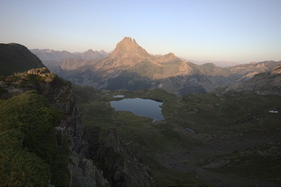
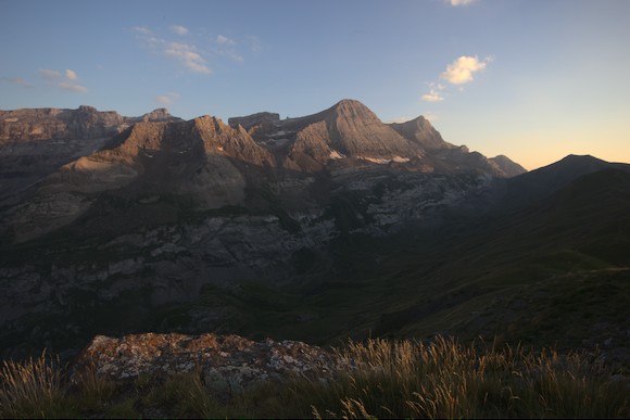
I had seen great photos of the area around Refuge d’Ayous and Lac Gentau, from here the Pic du Midi d’Osseau looks the most interesting. As this is only a short detour, I head for the lake as a bivouac site. There are already tents on every corner of the neighbouring lake, and Lac Gentau is like a campsite: about 150 tents, many people splashing in the water, playing Swedish chess or making a campfire, two drones buzzing in the air. Well, what did I expect on a postcard lake on a Saturday evening? I climb up to the pass behind the hut, look across the lake to the beautiful mountain and still have my peace there.
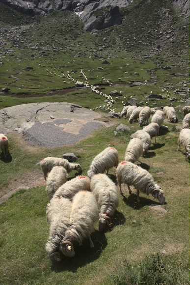
In the middle of the night, cows spread out between the tents in the moonlight, bellowing loudly. Two bulls fight with each other again and again when they are not mounting a cow. Both actions are accompanied by running back and forth–as I said, between the tents. At some point it is too much for me, I get up and drive the animals to the empty meadow next door. Of course, it doesn’t take long before they are back again and I have to get up again …
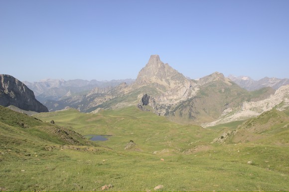
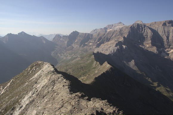
In the morning I am so tired that I didn’t hear my alarm and then only make progress at a snail’s pace. Anyway, once I’m back on the HRP route, I’m glad to have left the circus behind me. I cross the basin and climb over the pass right next to the Pic du Midi d’Osseau, which really looks good from every side. From here, the next mountain massif is clearly visible, but so is the deep valley into which I have to descend first.
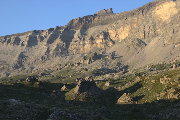
I don’t reach Refuge de Pombie until midday, no time for a long siesta. Fortunately there is shady forest down in the valley. The following ascent through the high valley drags on endlessly and it is far too hot. I wonder how long the weather will hold, so far I have hardly seen a cloud on the trek. Maybe I should paint some clouds in the photos so that the sky is not always so boringly blue? Another hiker says that the next few days are supposed to be even hotter.
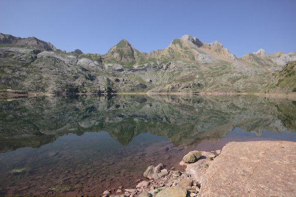
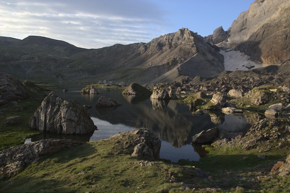
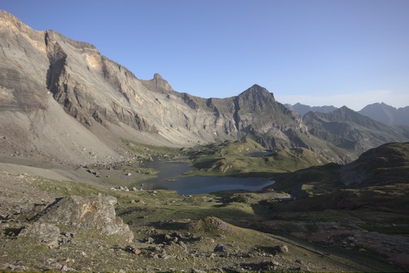
Arriving at a pass, things immediately get interesting again. Within a few minutes I come to a lake, Lac d’Arrious, next to a mountain that looks like Sugarloaf Mountain in miniature. On the Passage d’Orteig I have a via ferrata feeling for 5 minutes, a little later the tiny Refuge d’Arremoulit comes into view. It is beautifully situated on a lake between rugged granite mountains.
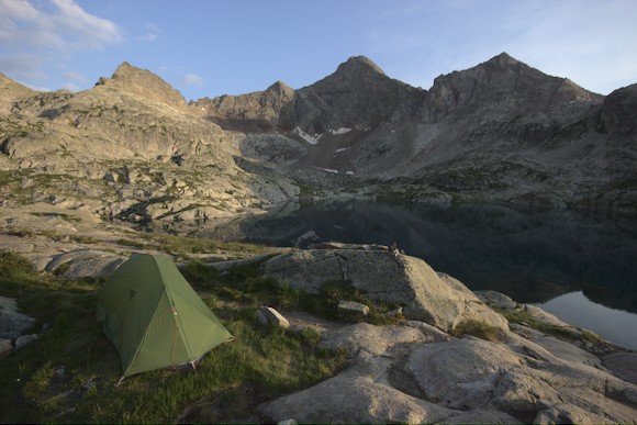
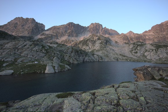
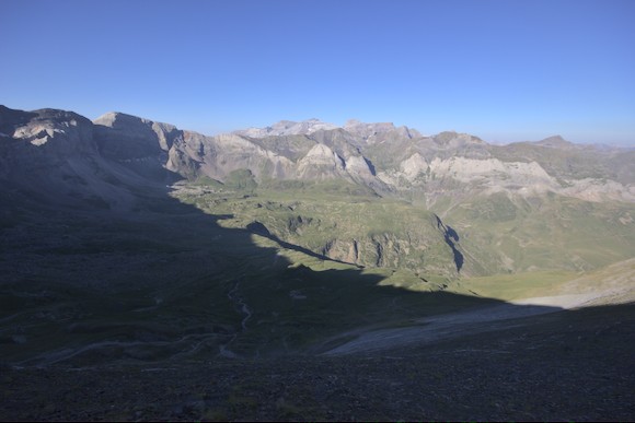
Here HRP hikers have to decide how to get to Refuge Wallon: the southern, shorter and faster variant (1 day) via the Embalse de Respomuso reservoir? Or the more alpine northern variant (1.5 days) via Refuge de Larribet? I decide on the northern option, but still take a walk up the pass over which the other option leads, just because of the view of two lakes and the 3000-metre Pic Balaitous. Then I enjoy the evening at the lake, my tent is directly above on a granite hump.
In the morning I follow the cairns to the first pass, Col du Palas. It’s not far to the next pass, Port du Lavédan, actually just crossing the steep slope … The markings stop at a boulder field and you have to figure out for yourself how to continue and where the weak spot is in the small rock bar. I enjoy it, especially as the view of the lakes deep below me is magnificent.
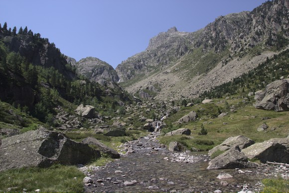
With a little scrambling I cross the saddle, then I pass a few lakes on the way down to the Refuge de Larribet, and I continue down the pretty high valley.
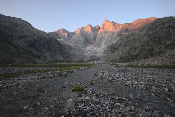
Of course I have to go up the next valley again. At some point I want to take a look at the altimeter, but the watch is not on my arm. At the last break I had taken it off to put on some sun cream. That was about an hour ago … So I throw the rucksack behind a stone block and sprint down again. With success, but after this action my schedule becomes quite tight, after all I still wanted to cross the next pass today. I do the last few hundred metres up to Col de Cambalès in the evening light. On the descent to the lakes on the other side, the mountains light up red. I head for a lake with a striking heart shape and find a nice bivouac spot. I eat at dusk and need my headlamp to brush my teeth.
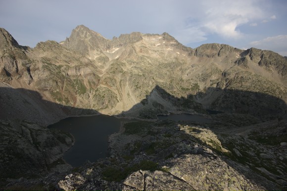
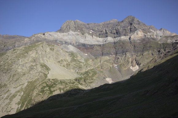
The descent to Refuge Wallon (closed for renovation and enlargement) is quick. A pretty area with a few pine trees in the meadows. At noon I am at the next lake, it is very windy and increasingly cloudy. Two more passes (between which I cross the slope), then down to the bivouac site at Refuge des Oulettes de Gaube. A really impressive site right under the north face of the Vignemale.
With the news that there is to be a heavy thunderstorm with hail late in the evening, the hut keepers spread mild panic at the bivouac site. Apart from distant thunder, however, nothing happens. The next day I am relatively lazy, I set off late and climb only as far as the Refuge de Bayssellance, and after a long break I walk the short distance to the start of the climb to the Vignemale. At a slightly exposed passage there is an elderly gentleman who at first glance looks like a normal hiker, with a sleeping mat on his rucksack. Only he doesn’t have walking sticks, but crutches! When I ask him what he is up to, he answers that he wants to go to the glacier and is thinking of turning back. I encourage him in this thought, but from a distance, from my bivouac spot, I see him still standing around for quite a long time. The rock above me looks pretty good, light marble, cut by numerous dark dykes.
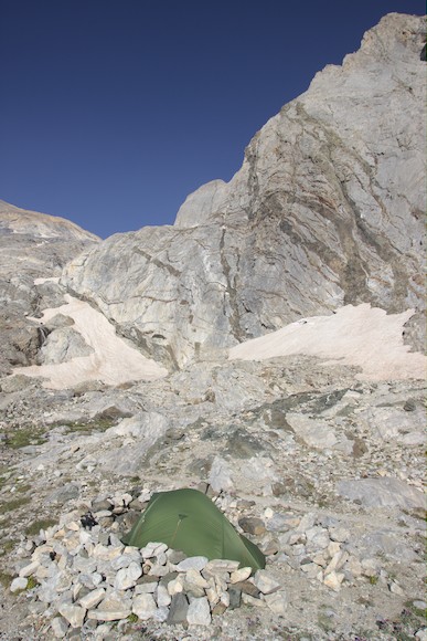
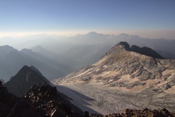
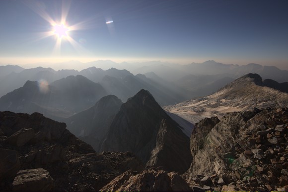
A strong wind comes up at night, pressing my tent to the side and pulling the pegs out of the ground. I have to get up and rebuild everything more stably with the help of stones and hiking poles. I set off at dusk with a light pack, upwards over round humps consisting of marble. Shortly after sunrise I reach the glacier that is lying flat in a wide bowl. I pass an jag with a deep view into the north face, then easy climbing to the summit. At 9 a.m. I am back at my bivouac site and take down my tent.
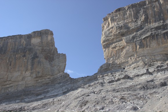
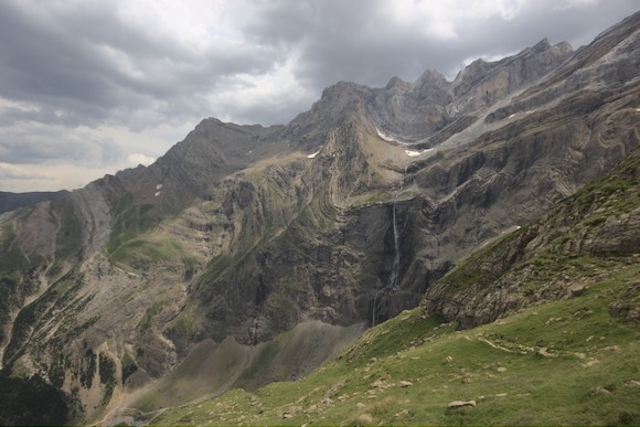
A long descent follows, down into the valley that leads to Gavarnie. Just before the village, however, I turn off the HRP route and climb (partly on ski slopes) to the saddle between Pic des Tentes and Pic de la Pahule. The latter is one of the best view points around the Cirque de Gavarnie, but this is obviously an insider tip, because I don’t meet anyone here. But first it thunders in the mountains opposite, while I pitch my tent and eat in the sun. Fortunately, it clears up a bit at sunset. I look across a valley on a long rock face with numerous peaks. The actual Cirque de Gavarnie is carved into this rock face, with the Grande Cascade, one of the highest waterfalls in Europe. On the far left of the panorama is the pass over which the HRP continues. And the mountain on the far right, Pic du Taillon, is my destination for the next day. A little to the left of it, a striking notch stands out, the Brèche de Roland.
The nappe structure of the Pyrenees can be seen well here (see also my book The Formation of Mountains). The Cretaceous and Eocene limestones that build up the mountains were pushed southwards. A deeper nappe of Palaeozoic sediments can be seen below. The valley floor in Gavarnie is an even deeper unit with migmatite.
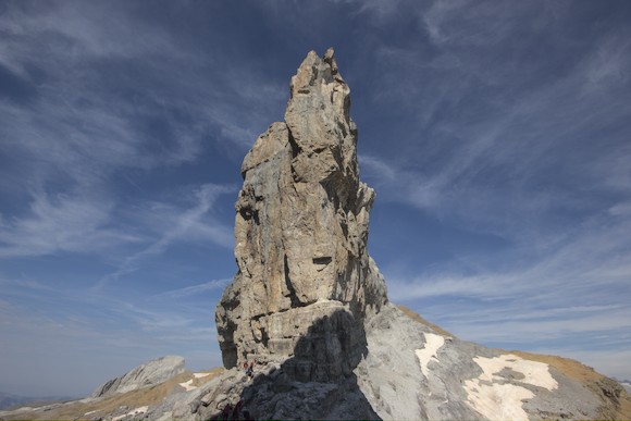
With minimal altitude gain, I reach the Refuge des Sarradets via Col des Tentes, Puerto de Burauelo and Col des Sarradets. I hide the large backpack and climb to the Brèche de Roland. On the Spanish side, I cross below the rock face to a rock pillar called Le Doigt, then the path leads up to the Pic du Taillon.
Back at the Refuge des Sarradets, I take the steep path (L’Échelle des Sarradets) that leads directly down into the Cirque de Gavarnie, constantly with a great view of the waterfall. Whereas it gets cloudier and cloudier.
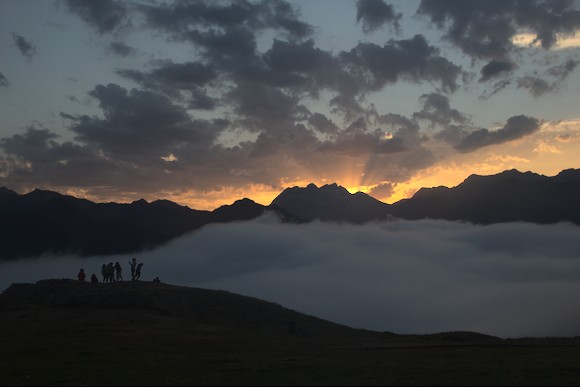
In Gavarnie I only do a quick shop, eat a pizza and then climb for another 2 hours in the fog to the Refuge des Espugettes. There I am just above the clouds, as long as they are not spilling up. I am just in time to witness the final act of a dramatic sunset, with red rays behind the Vignemale.
In the morning, I climb the lookout peak Piméné to see the Cirque de Gavarnie from the other side.
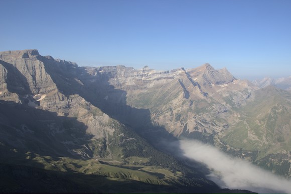
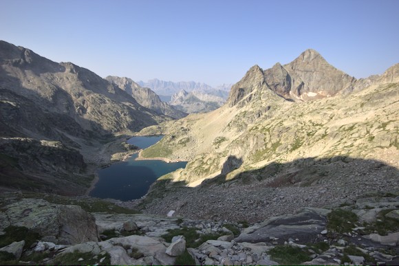
Via the Hourquette d’Alans I walk into the neighbouring cirque, the Cirque d’Estaubé. A little way down the valley I turn into the next valley and hike towards the Cirque de Troumouse. Even from a distance, I wonder where I’m going to climb up through this rocky bowl the next day.
The Cirque de Troumouse is quite different from the other rock cirques, you don’t feel enclosed, but have a feeling of vastness inside. The rock walls (mainly Devonian limestone and slate) surround a hilly plateau (migmatite) in a semicircle 2 km in diameter.
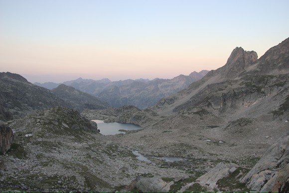
I bivouac at a dry lake in the middle of the Cirque. The ascent to the Col de la Sède is much further to the left than I had expected, really on the edge of the Cirque. For a long time I enjoy the view into the Cirque from above, before I hike to the next pass. From there I can see my destination for today, the Lacs de Barroude, deep below me. To get to the lower end of the rock face, however, I have to go around the neighbouring mountain, over two more passes. Once at the lake, I would actually have enough time to descend to Parzán. But why should I go down into the valley when I can stay another night in a nice place?
The next morning I descend into the pretty Barrosa valley. Here one of the overthrusts of the Pyrenees is clearly visible: The upper part of the rock walls consists of Devonian shale and limestone (and in places Silurian black shale), the lower part of granite, in places with sandstone (Permian/Triassic) directly under the fault.
Then another annoying march on a busy road to reach the supermarket in Parzán. Here I not only buy food for a week, but also superglue. I want to use it to slow down the rapid wear of my shoes.
HRP part 3: Crossing high passes