The High Tatras are a veritable treasure chest of a high mountain range: craggy granite walls and pillars, 1000 m high north walls, chamois and gentian (there are also well hidden bears) and above all countless beautiful mountain lakes in a very small area. It is mostly situated in Slovakia, with Poland getting a small, particularly beautiful corner.
It is the highest and most alpine part of the Carpathians, although, just for comparison, the area is much smaller than the former West Berlin. The High Tatras are often called the “smallest high mountains in the world”, but there are certainly other candidates for this title (Durmitor comes to mind, for example).
The entire area is protected by a Slovak and a Polish national park. Hikers must therefore stay on the marked trails — and since only very few mountains have a marked trail, most mountains may only be climbed with a mountain guide. Camping is prohibited and hiking is only allowed during daylight hours. However, there are enough mountain huts and worthwhile viewpoints.
On the Polish side, you can get there via Zakopane (train and bus, regular connection to Krakow). On the Slovak side, many possible starting points can be reached by the TEŽ narrow-gauge railway, which runs from Poprad (train, flight) along the foot of the mountains to Štrbské Pleso, although Štrbské Pleso can also be reached directly by rack railway from Štrba station (with e.g. fast trains from Prague).
I start on the Polish side, hitchhiking early in the morning from Zakopane to the Palenica Białczańska car park — better known as the car park for Lake Morskie Oko and also regularly connected by minibuses.
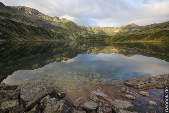
After a short stretch on the comfortable footpath, I turn into a side valley and climb up to the notoriously fully booked Five Lakes Hut (Schronisko Pięciu Stawów), where, still early in the day, I am still lucky to get a bed. Next to the hut and further up the valley there are actually — well, four lakes and some ponds (whichever one counts as number 5), namely Przedni Staw Polski, Wielki Staw Polski, Czarny Staw Polski and Zadni Staw Polski.
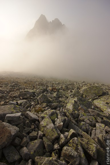
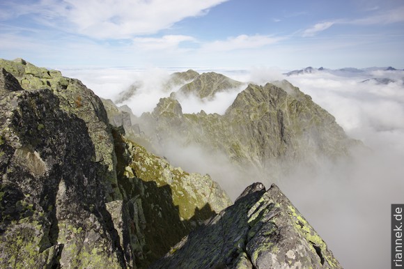
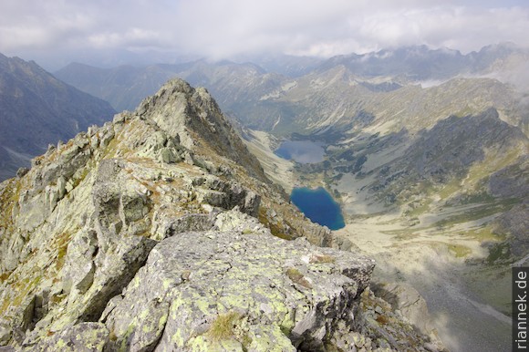
The goal of the day is the Orla Perć (Eagle Trail) via ferrata, which leads from the Zawrat notch along the crest to the peak Kozi Wierch (2291 m) and on to the Krzyne pass, i.e. parallel to the “five” lakes on the northern side of the valley.
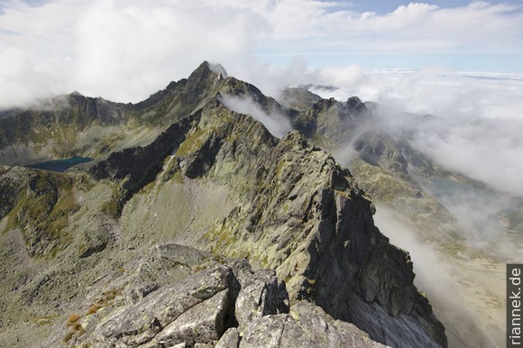
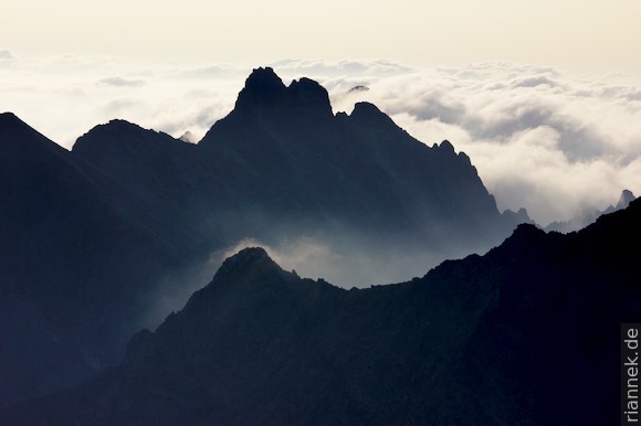
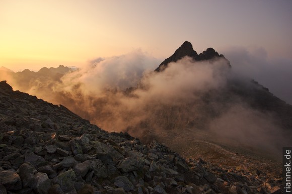
It is technically easy (often done without equipment), but in parts it is very exposed and the many notches and rock pillars add up to quite a few metres in altitude. I watch the clouds wafting around the mountains and every now and then I catch a glimpse of one of the lakes.
The next morning I get up early again and see how full the hut is: even in the corridors and stairwell people are sleeping, in the dining room there is not a square metre free.
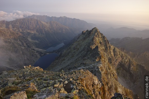
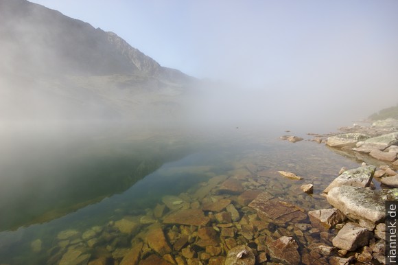
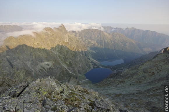
This time I climb up the other side of the valley to Szpiglasowy Wierch (2172 m), from the top of which I can see even 7 lakes (not counting the many ponds). One of them is the famous “sea eye”, the Morskie Oko, to which I now descend. It lies picturesquely below the 1000 m north faces of the Mięguszowieckie Szczyty and the Rysy.
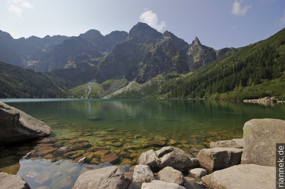
But it is not as lonely here as in the romantic pictures I saw in the cloth halls in Krakow: hundreds of day-trippers come along the footpath to the hut standing on the moraine and swarm out in all directions. I treat myself to an early lunch, walk along the shore and at the other end I climb steeply up to the lake Czarny Staw pod Rysami, which is one step higher. Again at the other end, the ascent to Rysy begins. It becomes steeper and steeper, first between the rocks and then over light granite with good grip to the summit. However, clouds suddenly gather and there is not much to see at the top.
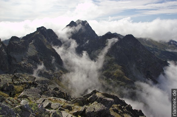
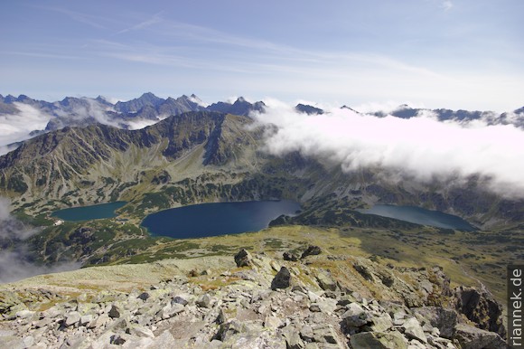
At 2503 m Rysy is the highest peak in the High Tatras that may be climbed without a mountain guide. And it offers a magnificent view: of Morskie Oko and other lakes, of mountains like Gerlachovský štít (the highest mountain in the Carpathians), Vysoká or Satan. The main peak of Rysy is just completely in Slovakia, while the northern peak, only a stone’s throw away and a few metres lower, is the highest mountain in Poland.
Fortunately, there is a hut on the Slovakian side only 300 metres down (the latrine with panorama window is magnificent) and I have a reservation, so I can give Rysy a second chance. Before breakfast, I am almost alone at the top with a magnificent view.
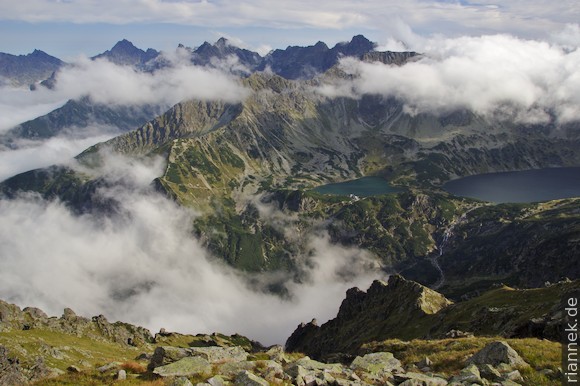
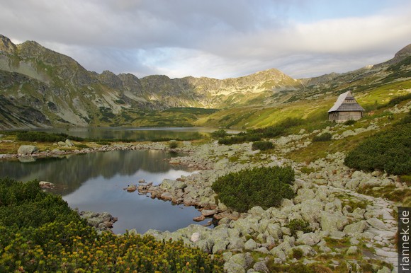
Later I descend from the hut to the valley floor and turn right, uphill to the next lake, Velké Hincovo pleso, and the next mountain, Kôprovský štít (2367 m).
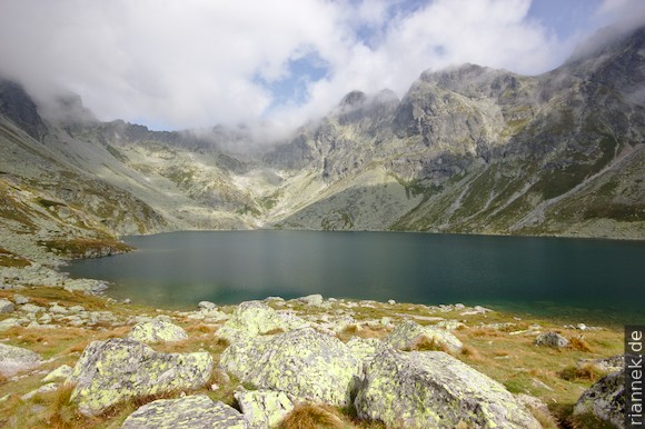
This is also a wonderful viewpoint, I especially like the view of the two lakes on the west side into the valley Temnosmrečinská dolina.
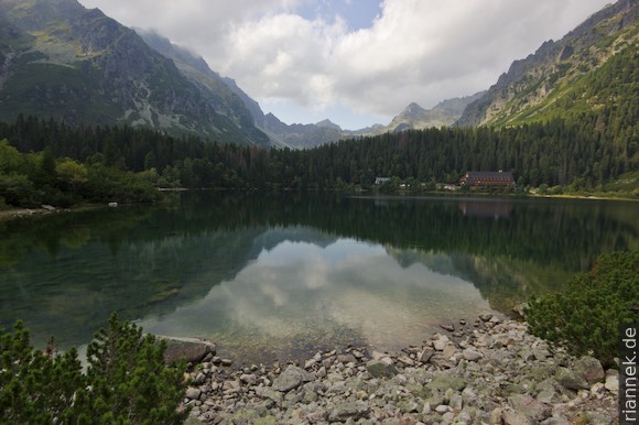
I turn around and hike down to the Popradské pleso lake, which is also frequented by many excursionists. Actually, I wanted to hike from here for a few more days in a wide arc to the eastern end of the High Tatras and back to the starting point on the other side, but I break off because of a text message calling me home. An hour later I reach the town of Štrbské Pleso, which is nicely situated on another lake, but otherwise quite ugly. At least there is a railway station.