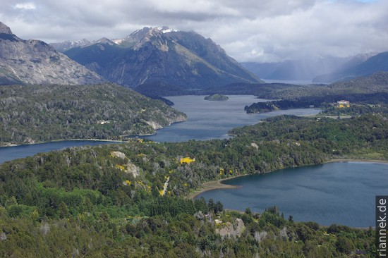
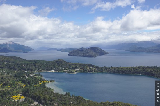
The “Saint Moritz” of Argentina, San Carlos de Bariloche, is a town full of chocolate shops and wooden houses, in an impressive landscape with countless lakes and mountain peaks (Nahuel Huapi National Park). Like every other tourist, I enjoy the incredible view from the Cerro Campanario, a hill just outside the city, which even has a chairlift leading up to the summit. You can see a tangle of lakes (Lago Nahuel Huapi and many smaller ones), islands and peninsulas, with mountains in the background.
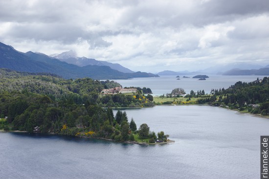
A few 100 m further on, I rent a bicycle and ride the so-called Cirquito Chico through this landscape. It takes me half a day for the not even 30 km, because I always stop at viewpoints. Especially the southern half of the loop is very beautiful.
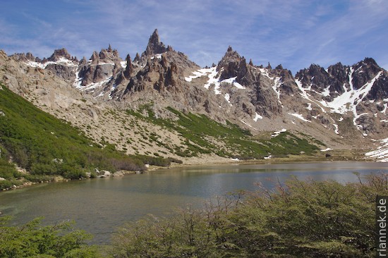
Much more exciting, however, is a hike through the mountains in the hinterland of Bariloche, with rocky peaks and cirque lakes that really do remind one of the Alps (only not of the Dolomites, it is a mystery to me how the authors of the hiking guide came up with this comparison. I’m thinking more of the Adamello).
I try the “Nahuel Huapi Traverse” and first climb up to the Refugio Frey. It is beautifully situated by a lake, behind it the rocky spires of Pico Catedral. I am reminded of granite landscapes in the Alps.
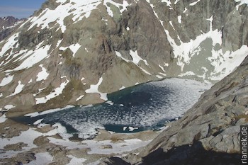
In the evening I arrive at Laguna Jacob (Refugio Martin). From here I wanted to cross a mountain over to Refugio Italia, but it is still too early in the year, I only get as far as a little above the half-frozen Laguna de los Tempanos. There is still snow in a steep gully, and as there is a rock face below, I can’t go any further without an ice axe and crampons (I would even have had the latter). There were also no tracks to be seen yet … So I have no choice but to hike down the long valley.
At the bottom I hitchhike to the end point of the traverse, my plan B is to do two small ones instead of one big semicircle. In the evening I arrive at Refugio Lopez, with a great view of Lago Nahuel Huapi. The view from Pico Turista, where I stand the next morning, is even better. The lake with its countless branches lies 1000 m below me. For a few minutes, the Tronador also emerges from the clouds, towering over all the other mountains by quite a bit.

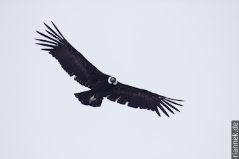
Next to the rock walls below me, a condor circles together with several smaller birds of prey. The condor comes within a few metres of me, remains motionless in the air for a few seconds and looks sceptically into my eyes …
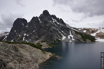
After crossing two passes, I am sitting at Refugio Italia, below the black rocky peaks at the Laguna Negra, which is also black. A waterfall falls from here into a basin, on the other side of which is the mountain I failed on the day before. I now follow the valley down and look forward to the shower …
Actually, I wanted to do another trek, but because of the horrible weather forecast, I spontaneously booked a flight that will take me 800 km south to El Calafate tomorrow.
By the way, I came here by bus from Pucon (Chile) via Martin de los Andes, a really beautiful route. At the border you wait with a perfect view of the cone of Lanin and later the Routa de los siete lagos curves from one mountain lake to the next.
Read on
Patagonia
Puerto Varas in the Lake District of Chile
Puyehue
Villarrica and Huerquenes
Conguillio National Park and climbing Llaima
Perito Moreno National Park and trek to Cerro San Lorenzo