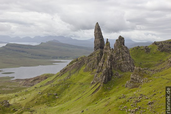
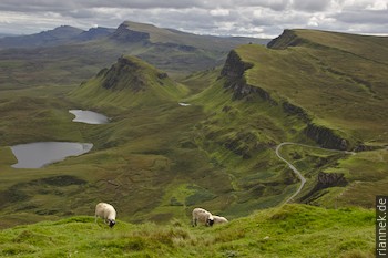
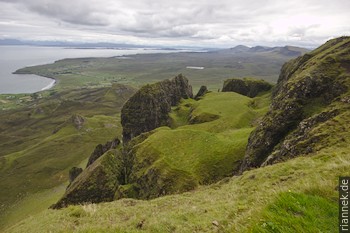
The Isle of Skye is easily accessible and offers some of Scotland’s most famous scenery. It is composed of many large peninsulas, separated by elongated bays. In the centre are the Cuillin Mountains, rising spectacularly from the sea. To the north, a smaller ridge runs along the Trotternish peninsula, with rock formations on its eastern side such as the Old Man of Storr on the Storr and The Table on the Quiraing.
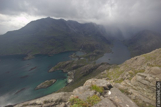
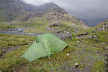
I start with a hike in the Cuillin Mountains, starting from the Sligachan Hotel (bus stop) on a path through a U-shaped valley that goes from sea to sea across the mountains to a lookout peak called Sgùrr na Stri (directions and map: Walkhighlands). I camped for two nights at the neighbouring loch, Loch Coruisk. Unfortunately, the weather was worse than its reputation: the weather forecast had even issued flood warnings, and accordingly it poured for two days without interruption. Dripping wet, I pitched my tent on the only patch of earth that was not underwater, an island between two branches of the path …
The views were nevertheless worth the effort and the hike is also geologically interesting. The island is largely made up of igneous rocks from the Tertiary period, with only the eastern tip and the east coast of Trotternish showing the older sediments (in which a dinosaur bone and tracks were even found at Staffin). The magmas are associated with the formation of the North Atlantic in the Tertiary. As the continents separated, strong magmatism occurred all along the developing ocean, which is summarised by geologists as the North Atlantic Igneous Province. The northwestern half of the Isle of Sky was buried under flood lavas produced by fissure eruptions. Somewhat later, gabbroic magma intruded and cooled in a large pluton: today’s black Cuillin Hills, impressive with their dark, sharp ridges. This was followed by smaller granite intrusions, today’s Red Cuillins in the east of the small mountain range, which are rather hilly and reddish.
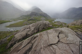
The gabbro is very heterogeneous and during the hike you can really see the processes that take place in a so-called layered mafic intrusion. Strictly speaking, they are differently composed crystal cumulates, depending on what just “rained down” on the bottom of the pluton and in what quantity. I see layers that resemble sedimentary structures, streaks and dykes. Sometimes there are pegmatoid areas with large pyroxene crystals, then olivine (whose iron on the weathered rock surface is responsible for the reddish colour) predominates again.
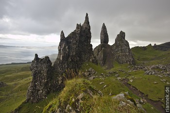
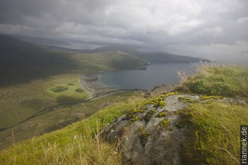
While I explore the Trotternish (by bus, hitchhiking and on foot), the weather unfortunately still leaves much to be desired. The ridge that runs lengthwise across the peninsula consists of Tertiary flood lavas. However, these heavy rocks lie on a poor foundation, namely easily deformable Jurassic sediments. After the Ice Age, entire hills slid down along the eastern side of the range. In the process, they have rotated slightly and lie next to each other like toppled dominoes. Some have eroded into bizarre rock formations, the most famous being the Old Man of Storr. Further north, at Quiraing, a walk with beautiful views is worthwhile. Here you will find The Table, a completely flat, grassy plain hidden behind rocks.
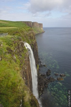
On the coast, it is worth stopping at Kilt Rock View Point. At first glance, the rocks of the cliff resemble the flood lavas further up, but in this case the magma has penetrated between the older sediment layers as sill.
Read on
Eilean Donan Castle
Ben Nevis and neighbouring Munros
Glen Coe
Hike in the Cairngorms
Unconformity at Siccar Point
Orkney Islands
At Fingal’s Cave on Staffa