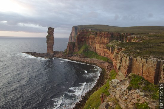
The islands immediately north of the Scottish mainland, between the North Sea and the North Atlantic, are a worthwhile destination for two reasons. There are stone circles, graves and villages from the Neolithic period (and also remains from the Iron Age) for anyone interested in early history. And the cliffs offer interesting coastal landforms, including some beautiful sea stacks. The largest is the Old Man of Hoy, about 3 times as high as the only German example, the Lange Anna on Helgoland. Incidentally — as the Orkneys, with the exception of Hoy, are only gently undulating — you meet more cyclists than walkers here.
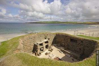
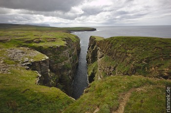
I start with a walk along the west coast of the main island (Mainland), from Skara Brae to Stromness, which is possible as a long day walk. Skara Brae is the ruins of a Neolithic village, very impressive, with the small museum and a reconstructed house. From here I follow the “Footpath” sign along the beach for a bit and then up the cliff. You reach Yattna Geo, a gorge-like bay. There are several such coves here, called geo in Scottish, which were formed where cliffs could be eroded more easily by waves, for example on faults. A little further on, at the highest point, the view opens to the south to the mountainous island of Hoy, in front of whose cliffs the Old Man of Hoy can be seen. Less than a kilometre further on, you come to Ramna Geo, which is 50 m deep and 300 m long. (There is a fish fossil site here, but collecting is prohibited).
What you see on the Oakneys are mainly sandstones, but also mudstones and other rock types. All of this was deposited in the Devonian at the fringe of the Caledonian Mountains, by rivers, on alluvial fans, blown together by wind to form dunes in a sandy desert, but also in a large lake called Lake Orcadie, whose size fluctuated.
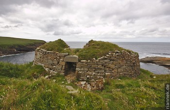
A little further on, you pass the ruins of a massive tower, Broch of Borwick. It is a tower of the Picts, who lived here during the Iron Age (the Romans built the Hadrian’s Wall because of them). Right next to it is my first sea stack, but it is quite small.
A little later I reach Yesnaby, with a small car park next to WW2 bunkers. Near the edge are beautiful stromatolites, the deposits of cyanobacteria that lived on the shallow shore of the lake.
The following bays show particularly interesting coastal landforms, with pillars and gates. The best-known sea stack in this area is Yesnaby Castle, on whose rock face the layers of the former sand dunes can be seen beautifully. I had imagined it to be bigger, though.
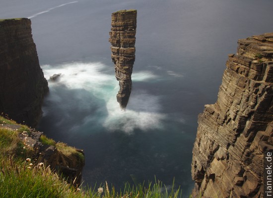
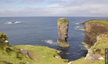
Along the second half of the route to Stromness, the cliffs are higher but also, with one exception, more monotonous. That exception is another sea stack, North Gaulton Castle. From a certain perspective, it looks very fragile, with a real wasp waist. With Stromness, Scapa Flow finally comes into view, an expanse of water enclosed by the southern of the Orkney Islands. It is a huge natural harbour with a long history, especially for the British Navy during the world wars.
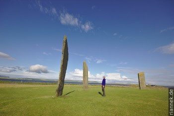
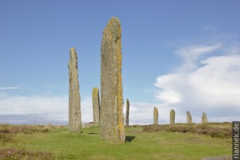
Easily accessible by bus is the “heart of Neolithic Orkney” (map). The main sites are located on a causeway separating the two large lochs in the centre of the mainland. There are two stone circles: Of the Stones of Stenness, three large stones, a small one and remains of a dolmen and hearth still stand. The Ring of Brodgar is a little younger, 104 m in diameter, and there are still 27 stones standing, but smaller than the former circle. The former is often associated with life, the latter with death. Between the two stone circles, a newly discovered settlement has been excavated since 2003, which was probably a kind of temple and pilgrimage site. Another small settlement was Barnhouse, directly behind the Stones of Stennes. You also pass a few more stelae during the short walk.
Just a kilometre away, next to the road to Kirkwall, is a mound worth seeing, Maes Howe. It is definitely worth taking a tour inside and listening to the theories of the archaeologists. It is advisable to reserve in advance! The tomb is almost 5000 years old. The chamber inside is made of huge stone blocks that are perfectly joined together. The Vikings were also here once, seeking shelter from a storm in the chamber and carving runes into the walls out of sheer boredom. For example, “Bjorne Thorsson carved these runes very high”.
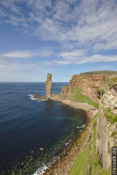
The Isle of Hoy can easily be reached from Stromness as a day trip, but the beautiful bay of Rackwick alone, with free camping on the beach, is an argument for at least one overnight stay. From the ferry terminal, it is either a minibus ride or a 2-hour walk to the other side of the island to Rackwick. The footpath (map) leads nicely over a flat pass between the two high mountains and along a moorland stream. The Old Man of Hoy, at 137 m the highest sea stack and virtually the icon of the island, is a 3 h walk from here and back, or correspondingly more if you explore the paths along the cliffs. Contrary to the usually enormous time periods of geological processes, erosion on a cliff is relatively fast: 250 years ago, the Old Man did not exist, but instead a small peninsula that was gnawed by the high waves during violent storms. Old paintings show that at first the pillar was wider and had a small rock gate at the base, then in the 19th century the half facing the coast collapsed. It is only a question of time that the rest will be absorbed by the waves.
Read on
The Formation of Mountains
Isle of Skye
Eilean Donan Castle
Glen Coe
Ben Nevis and neighbouring Munros
Hike in the Cairngorms
Unconformity at Siccar Point
Orkney Islands
At Fingal’s Cave on Staffa